DANUBEparksCONNECTED Bridging the Danube Protected Areas towards a Danube Habitat Corridor

Cycling the Danube in Romania


Small Wetland of Brăila Natural Park
- Floating rangers and angry poachers

One thing that I liked a lot on this long journey was that despite the fact that all the head offices of national parks and protected areas shared the same idea, had the same reason to exist and were situated on the same green-blue line – each of them was different and original in its own way. And once more I wasn’t disappointed when I arrived at the address of this Natural Park’s headquarter: this large, three-floored Thing from the photo below was merrily floating in the harbor of Brăila. And I could imagine my host, Mr. Bogdan Albu, being gently cradled somewhere up there.

How long do you enjoy this cradle…  I mean, how long do you work here?

“The Park was established in 2000, but since 2004 we have our own administration and I've been here since that time.

In 2001 the Park was declared as Ramsar site, i.e. a wetland of international importance. The ground for that was that it preserves nature on 25,000 ha of wetland, with birds as a primary value.  Cormorants, pelicans, white and gray stork, wild ducks… There are also 10-15 white-tailed eagles (the number changes from year to year). And let’s not forget: we are members of the Danubeparks Association.”

It is definitely nice to work in an office positioned directly on the Danube?

„This spacious floating facility with exhibition space, conference room, and our offices was provided through an infrastructure program conducted in 2012-2015 and financed by the EU. It was built in Giurgiu (Romania) and delivered to us at the end of 2015. (and it is not a boat – it doesn’t have engines). Before that, we were accommodated in Brăila Forestry Directorate. Our permanent exhibition that you can see on the ground floor was also created in the frame of the same project.”

Cross-section of a tiny corner in a wetland

Snowy weather in the floating exhibition room!

Dioramas also show scenes from traditional fishermen life

Let's talk openly now: if this is the Small wetland of Brăila, where is the Big wetland of Brăila? (Better admit if you try to keep it a secret, in order to retain here visitors like me.)

“The history goes like this: in the 1960s and 1970s there was a huge single island here - the Great wetland of Brăila. However, due to the construction of irrigation canals combined with the widening of the Danube, the island was divided into one large and several small parts. Most of the large part was then drained and become an agricultural area (it was bought last year by a Saudi Arabia investor) – that’s why there is no Big wetland of Brăila.

The smaller parts formed eight islands, and that is the territory of our Park today. It was preserved as a nature value thanks to the fact that after 1990, with the end of communism, the ecological awareness has grown, modeled after good examples from West Europe. But still: the Great wetland of Brăila had an area of 160,000 ha, and after mentioned hydrological works it was reduced to present area of 25,000 ha.”

The size of the remaining part has to be accepted as some kind of consolation:  it is big enough that it can’t be completely seen in one day. Take look at the maps below: the straight distance from the top (Brăila zone) to the bottom (Magureni village in Dobrogea) is 50 km.     


On the left map:
- Grey area: larger part of the former Great wetland of Brăila, converted to agricultural land
- Green zone along the Danube, to the left of the grey area: remaining part of the wetland – the Small
  wetland of Brăila

On the right map: lakes of the Small Wetland of Brăila                                                      

To better understand the structure of the Park, one needs to know that there are theree levels of nature protection in Romania:

- Buffer zones;

- Strictly protected zones (visit is possible after an announcement);

- Integrally protected zones (entering possible only when accompanied with rangers, the only form of tourism is visiting, no other human activities allowed.)

The Park has two integrally protected zones and a buffer zone on the Danube bank. The rest of its territory is under strict protection.
The plan for my visit was to have a boat ride in the northern zone of the Park. And it turned to be a really great experience. We first glided downstream for a couple of kilometers, then turned into a narrow channel full of mosquitoes that led us into the inner water world of the Island Fundu Mare.

   Rangers’ fleet.

Though the narrow channel, towards the inner lake of the wetland.
The canal is the only way to get there. In times of high water, it is changing
every day and can be blocked with fallen trees or branches.


“If the Danube is high in November and December, then water remains in these lakes, and they completely freeze during the winter. Otherwise, there is no water in the lakes during the winter, and they can be crossed on foot. That is when game appears here - deer, wild boars, rabbits, beavers (they come when the water is shallow, 1-1.5 m) and even cows pay visit.”, said Bogdan

“On the Park’s northern island, Fundu Mare, we use an embankment with a metal sluice to regulate the water level. After 4-5 unsuccessful attempts to build a permanent embankment using only local materials (wood and stones), a certain amount of concrete had to be added. Another embankment with a sluice is positioned in the south end of the Park (near the village Mărașu) and regulates the water level in a zone which is under special protection regime. We open and close these sluices several times a year in order to keep water in the wetland as long as possible: when there is water there are fish and when there are fish, birds have a reason to stay. We monitor the water level manually, by direct access.

To provide even more water, we created a channel in the southern part of Island Fundu Mare through the LIFE project. That channel reduces siltation of the lake. During the dry season in 2009, we used mechanization to deepen the canal by 2.5 m. The work was carried out on a 400 m long stretch and lasted eight months. The result is that the water remains in the lake one month longer than before,  usually until late fall. (The lake then recharges in the spring.) But the process will have to be repeated every 10-15 years.
The year 2010 was historic because the Danube reached a water level of +700 cm (at the time of my visit, after days of heavy rains, the level was + 586). Some communities were flooded and the entire island Fundu Mare (i.e. the northern territory of the Park) was under water.”

Bogdan Albu and his colleague, the park ranger

“Besides nature protection and conservation, our main additional activities are monitoring of the protected area and prevention of poaching. Fishing is only allowed in the Danube and not in the Park area. Poachers looking for anything they can get, and the preferable catch is pike and carp eggs: they are the source of a sort of caviar that is cheaper than the one obtained from sturgeons. Most of the poaching happens from the end of April to the beginning of June because that is the reproductive period for most fish species. Fifteen years ago, poaching was a big problem because we didn't have the necessary equipment nor enough staff. We now have eight rangers and four motorboats. 

A good thing here in Brăila part is that it is hard for poachers to enter the inner lake of the wetland (the most precious part of it) because it is naturally protected: the only entrance/exit is through a channel that is used by tourists and rangers – there are too many witnesses to run into.

Our rangers are at the same time our security personnel and our tourist guides. Actually, everyone here must be ready to perform more than his basic duty - I am an IT engineer, but also a guide for foreign groups.”

The inner world of Island Fundu Mare.
The depth of the lake is 2-3 m and 1-1.5 m in the average.
(The depth of the Danube in Brăila zone is 10-15 m)

“As for the forests, we replace the American and European poplar (white, black) with white willow. And we gather seeds od different tree sorts. We also suppress the aggressive Amorpha fruticosa on an area of 200 ha (the first phase was through a pilot program and after that we worked through the LIFE program). We do not just cut that plant, but completely remove it during the autumn and winter when the terrain is accessible. (Although I can mention that beekeepers love Amorpha because bees make beautiful honey from it.)”

Cormorans in sight! An opportunity to enjoy watching them on their skyscrapers.

“Our annual number of visitors is 10,000-12,000, and they mostly come at weekends. We have a steady increase in foreign visitors numbers: their share is now at 20-30% of the total visits. Twenty-five percent of foreign visitors are experts and 75% of them are tourists from cruise ships who come to us during their typical two-day stay in Brăila. A word about us is expanding very quickly and there are already plenty of tourists who come to Brăila especially to visit us and then the Danube delta.

We plan to provide a special service boat to clear the grass in the lakes and to maintain a "road" for canoes and small boats with visitors. And we also hope to have soon one tour boat with the space for 18 persons.

There is a study trail on Island Fundu Mare that is a couple of kilometers longs. At the moment info boards and signposts are removed due to the high water, but will be returned in a period when one can walk along the whole trail (usually from September).”

I asked Bogdan the standard question about success:

“The way I see it, we achieved two important goals here:

- Large reduction of poaching, which was a big problem in the past as offenders used to enter lakes and to cast their nets that were harming birds as well. We have practically eradicated this crime in the last 10-15 years.

- Educational activities in the local community, with a „from tail to head” approach: we increase awareness of children that it is good to protect nature and then let them pass that attitude to their parents. Children come here for presentations and lectures, but we also visit local communities with this program. We also produce textbooks for young children.

As for our general status in the local community, there is sometimes a bit of resistance towards some of our actions and rules, but it is not a significant problem. “

On the way back to Brăila we witnessed a probable case of poaching.
Noted criminal equipment: beer, cheese, and sunshade.

The subject of theft: essence de la vie.


LOWER PRUT BIOSPHERE RESERVE - Visiting a relics of the Danube

To visit this reserve I left the route to Tulcea for a couple of days and cycled north on Romanian side from Galați to Oancea, then crossed the border with Moldova and ended in town Cahul. Next morning I went to the central city square, to meet a group of local cyclists and my host Anatolie Risina, project manager.

We cycled from there back towards Galați but this time on Moldova side, along the Prut basin. It extends to the south-east and the terrain is kind of flat but with many small hills and with maximal elevations of 120-140 meters. And so it was along the way: uphills and downhills were following each other.

The Prut river forms terraces with ponds and couple of big lakes. In the upper part of the river, large wetland areas had been dried out for agricultural purposes in the 1970s, which of course reduced habitat space for many species and changed the hydrological regime of lakes and wetlands, etc.

The lower part of the river remained relatively unchanged and retained most of its original forest ecosystems, grass meadows and wetlands. To protect and upgrade these natural values, the Lower Prut Nature Reserve was created in 1991. Approximately one third of the Reserve was occupied by Lake Beleu – a several thousand years old relics of the Danube.

At the end of 2015, the local Council of Cahul district in agreement with local communities declared the status of Biosphere Reserve to the rest of Lower Prut valley, covering an area of around 14,800 ha. It is now a protected zone with limited access, mainly for research activities.

The Reserve now includes floodplain lakes Manta (1880 ha plus 3239 ha of wetlands) and Beleu (960 ha plus 2285 ha of water ecosystems). Both of them are Ramsar sites.

Today's menu: open spaces and distant views

Embankments of Lake Manta’s fishponds

A small caravan but serious logistics

Riparian forests occupy in total 10% of the territory of the Reserve.  Since 2000, according to an agreement signed by Romania, Moldova, and Ukraine, the Lower Prut has a status of the green corridor between these countries.

The ecological importance of the area is recognized nationally and internationally. And it practically represents an entrance to the Danube Delta Biosphere Reserve: it lies on the route of migratory birds and offers resting, nesting and wintering space for more than a hundred bird species. More than 50 of these species are listed in the EU Birds Directive, in the Bern Convention and in the Red Book of the Republic of Moldova.

Local economic is mostly related to fishing and agriculture. Agricultural land along the Prut is cultivated mostly on traditional ways and properties are small, usually tied to households. Produced crops have good quality due to low use of chemicals and due to the fact that and grape, cereals, vegetables, and other crops are native species. But agriculture provides a modest level of living standard to local people who sell their products on markets in Cahul or in Romania, and it is a constant struggle: the average general income is about 100 EUR a month per capita. Prolonged economical crisis leads to depopulation of the area and it is estimated that 30-35% of local people work abroad on a permanent or temporary base.

The buffer zone of the protected area is also covered by
water ecosystems and meadow vegetation

I asked Anatolie what are expectations of this brand-new reserve in the light of the mentioned situation:

"The Reserve can promote the development of organic farming as well as cultivation and labeling of local quality products, and thus can foster social and economic development. Estimations predict that the area for that kind of farming could be around 3000 ha in the Reserve only, some 500 new jobs would be created, and the resulting increase of the average local income would be about 20-25%", says Anatolie. " It should also inspire the development of rural tourism in the region because there is a good base for that."

The tourism potential is real, with the urban population from Moldova and Romania as its target group. Data show that in 2012 and 2013 there were circa 12,000 visitors who stayed in the region 3-4 days, mainly in private accommodation of a decent level. The estimated benefit was a 40-50% increase in family budgets. Local population is definitely more and more aware that the Biosphere Reserve has a positive influence on that trend.

Visiting a hidden view point above Lake Beleu, in village Slobocia Mare

Visiting a hidden view point above Lake Beleu, in village Slobocia Mare

There is an important plan to recover reed belts in the lower part of the Prut river in order to restore habitats in the Reserve. This would also improve water quality: studies show that the level of nitrogen in water ecosystems would be decreased by 30-40% and level of phosphorus by 40%, thus reducing eutrophication (excessive growth of algae and other plants due to a high content of minerals and nutrients in the water). The restoration of the reed belts would be applied in the area of around 10,000 ha and great part of investment could be returned by using obtained material for heating, in construction, etc.

The first lake we passed was Manta. During the Soviet era, this and some other lakes were used as industrial fish breeding ponds, but in the last 25 years they are used for that purpose only by local population and on a small scale. According to last research studies, the fish diversity is improving.


                       The taste of perspective                         On the Lake Beleu

The destiny of this modern, conspicuous „palace“ on Lake Beleu is to become an attractive accommodation point in the future. At this moment it is just a lonely and silent place.

Alas, the water was high, and we couldn’t enter much into the reserve anywhere

Both Manta and Beleu are shallow (the second one has an average depth of only 0.5-1.5 m, with a maximum depth of 2 m). The north side of Manta always has water, and its western part is mostly dry. But this year, due to a lot of rain, there was 1-2m of water even in the western part.

The second lake that we passed was 5 km long and 2 km wide Beleu. Since 1991 the lake and its adjacent area are a strictly protected zone, with the goal to protect water-based species. The regime was declared by the Government of Moldova and is controlled by Cahul regional environmental Inspectorate. But commercial interests have an advantage over nature protection and there is an intensive oil extraction activity in the lake zone: oil fields cover around 30% of the area and boreholes that are located mostly in the upper part of the lake give around 30,000 tones of oil per year.

I said goodbye to Anatolie and my cycling friends in the small town of Giurgiulești (that has the largest port in Moldova) and went back into Romania, right into the black wall of a torrential downpour. There was an irresistible joy in the form of a roof above my head in the nearby Galați, and the last part of my journey along the Danube had to wait until the next day.


THE DANUBE DELTA BIOSPHERE RESERVE
Biospherical Danubean Finale Reserved for The Delta


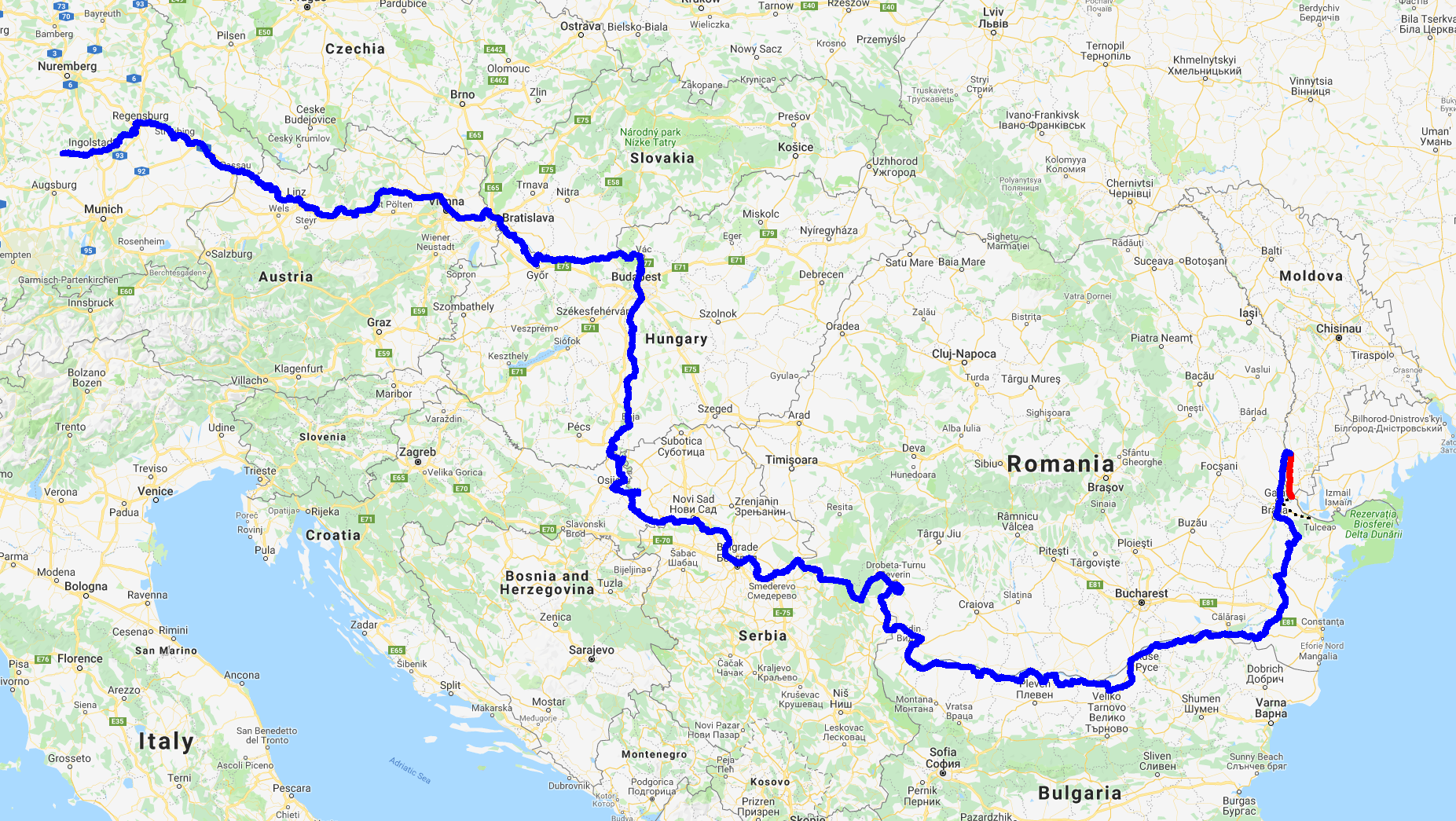
For the third time in the past five years I cycled up the last of countless hills on the 80 kilometers long road from Galați (yes, this leg is quite strenuous), entered the first streets of Tulcea and then quickly descended through the sunny afternoon to a long, lively, charmed promenade along the Danube bank.


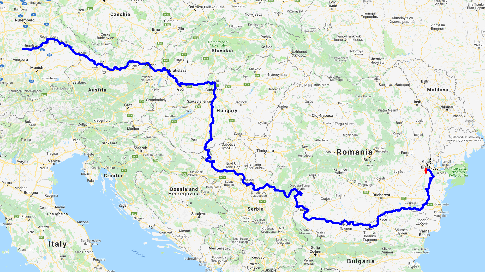
For those who want to ride the full length of the EuroVelo 6, this is not the end - there are couple hundred kilometers left to Constanța. (And one has to bear in mind that the EuroVelo 6 is not only a route along the Danube: it starts on the Atlantic ocean and goes to the Black Sea). But for those who wish exactly to follow the Danube from its spring to its end (and they are the majority), Tulcea is the right address. To be more precise, it is the best address that you can get: the Black Sea shore is still 80 kilometers away, and to go there you will have to take a boat to reach a tiny town Sulina at the end of the central channel in the Delta. Is it disappointing thing after cycling three thousand kilometers along the Danube? Not exactly: from the pier in Sulina you can proudly pedal four kilometers to the warm, white sand on the local beach, and that’s it: there is a small wooden dock there, that will allow you and your bicycle to pose for that perfect photo right above the waters of the Black Sea :)


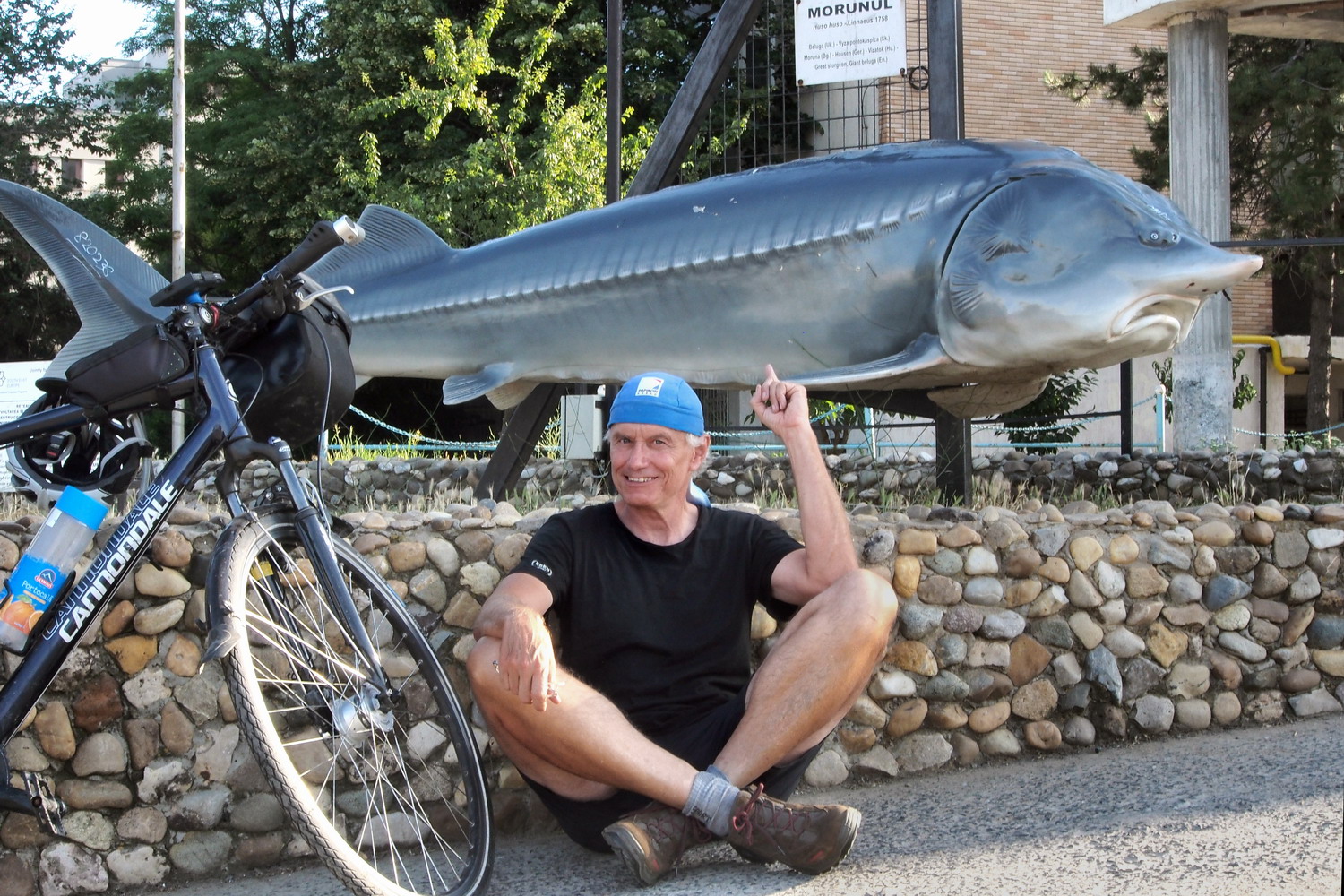
At the end of the stunning online game. “Online” means on-the-line-of-the-Danube :)
The task was to collect magic keys by touching these identical sculptures of the
sturgeon - the first copy was in the yard of the Danube-Auen National Park,
downstream from Vienna. Alas, I discovered in Tulcea that I didn’t complete the
challenge: somebody told me that there should be one more sculpture somewhere
in Bulgaria. This means that I will have to travel along the Danube again.

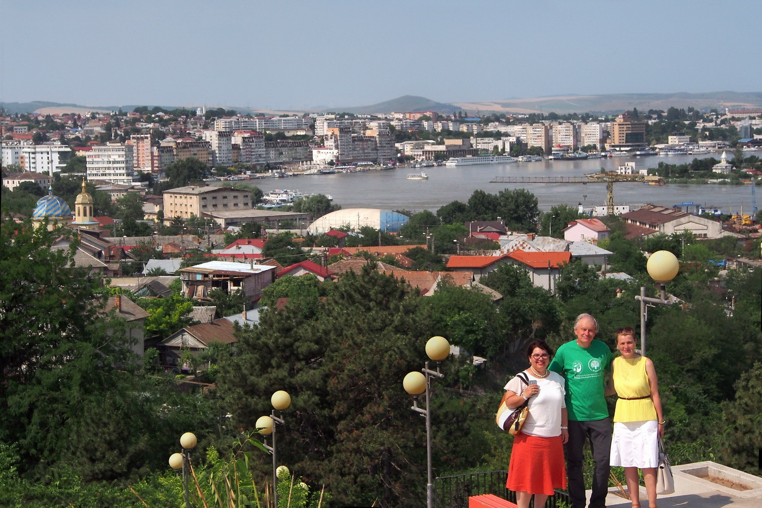
The view of Tulcea with my hosts Garbiela Morozov (left) and Gabriela Creţu (right)

A crescendo at the end of a classical music piece is a demanding and dangerous challenge for a composer. It must be no less than a  perfect culmination, grandiose enough to meet all of our ruthless expectations after listening to so many tones before it. An ungrateful task, and there is no mercy: the result makes the difference between being a craftsman or an artistic genius. It is this-or-that, there is no compromise.

But the Danube Delta does not care about rules of classical music: its composer was an emotionless (although infinitely persistent) craftsman, but the result is ingenious. That is what Nature does: it blindly and indifferently composes places and then leaves them to us, to adore them and to project into them what we want to see as an imprint of a genius. The Delta does not disappoint in that sense: it is a perfect crescendo at the end of the Danube Concerto.

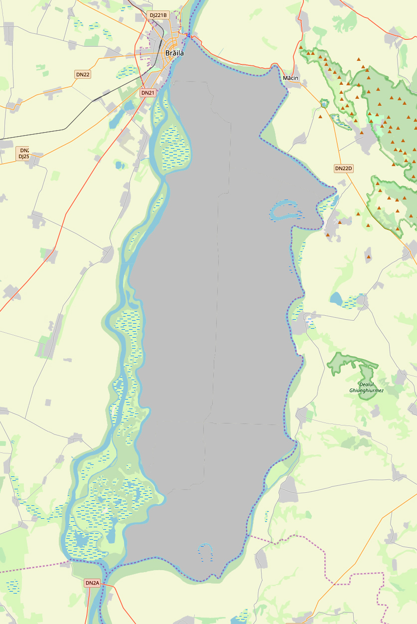
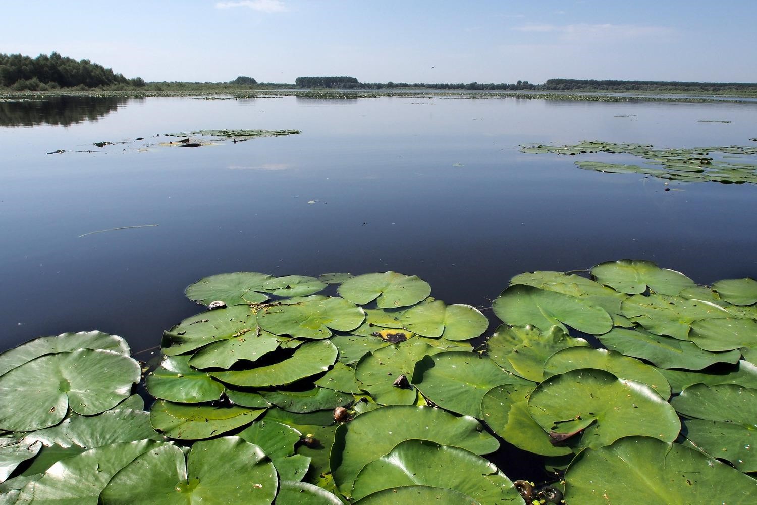
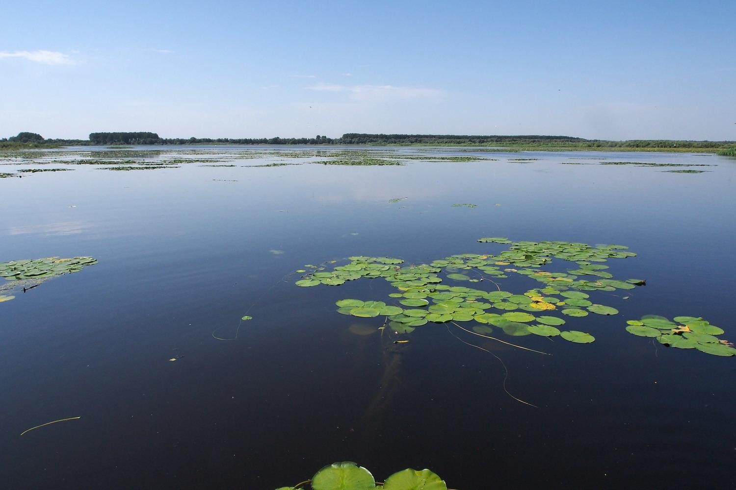
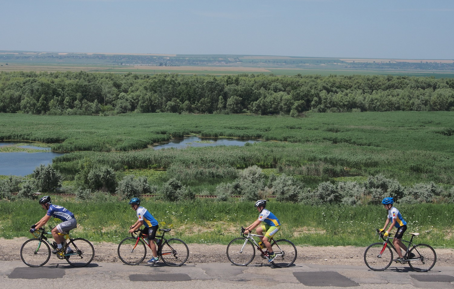
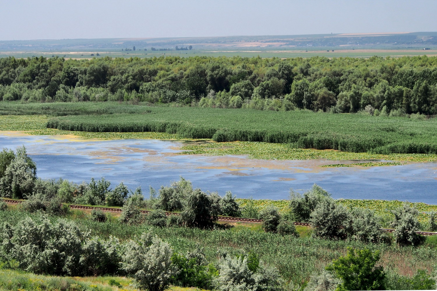
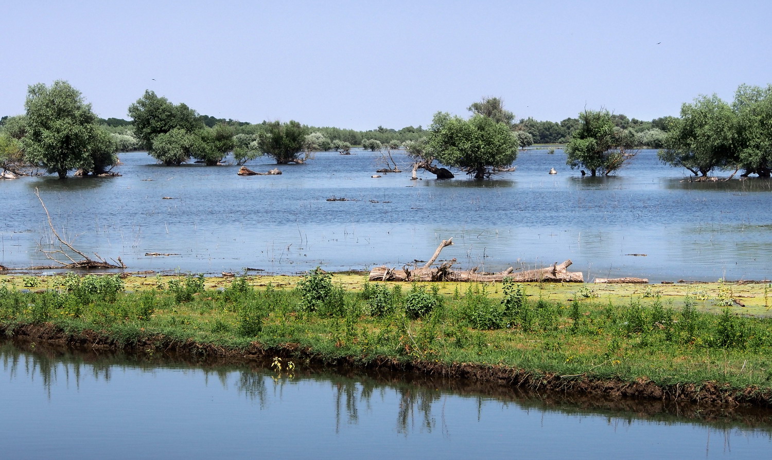
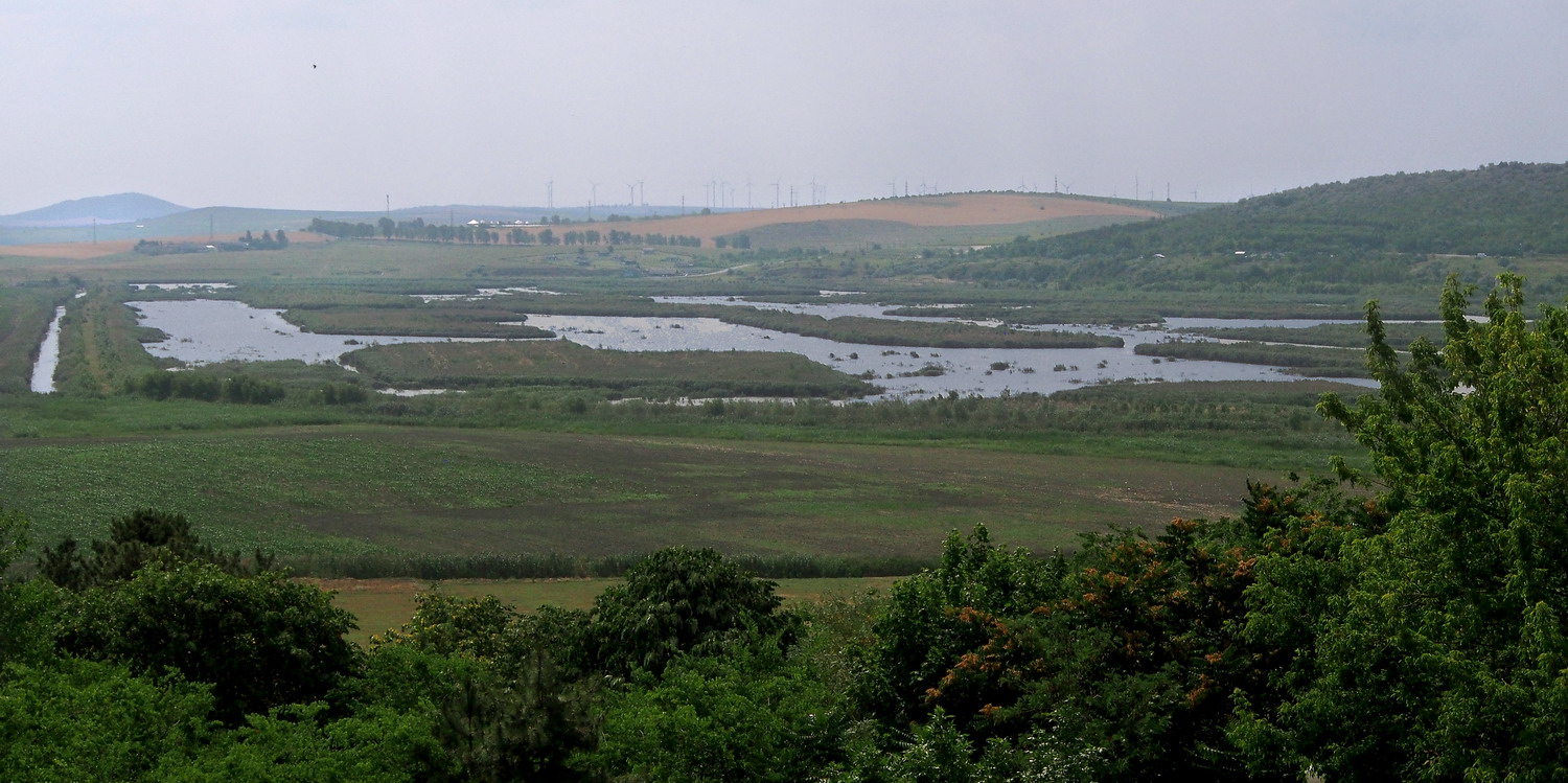
The Danube Delta is the largest wetland in Europe – it covers an area of approximately 4,300 square kilometers. This gigantic labyrinth of countless lakes, channels, and islands at the end of a 2,860 km-long river is shared between Romania and Ukraine. Much of it (approximately 1,700 square kilometers) is overgrown with reeds and it is the biggest reed bed in Europe (and probably in the world). This natural filter also makes it Europe’s largest water purification system. Since 1991 the Delta has been on the UNESCO World Heritage List, and in 1992 was internationally recognized as a biosphere reserve.

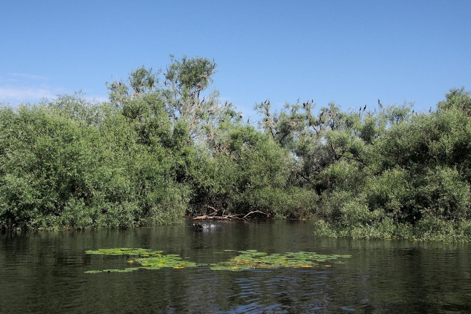
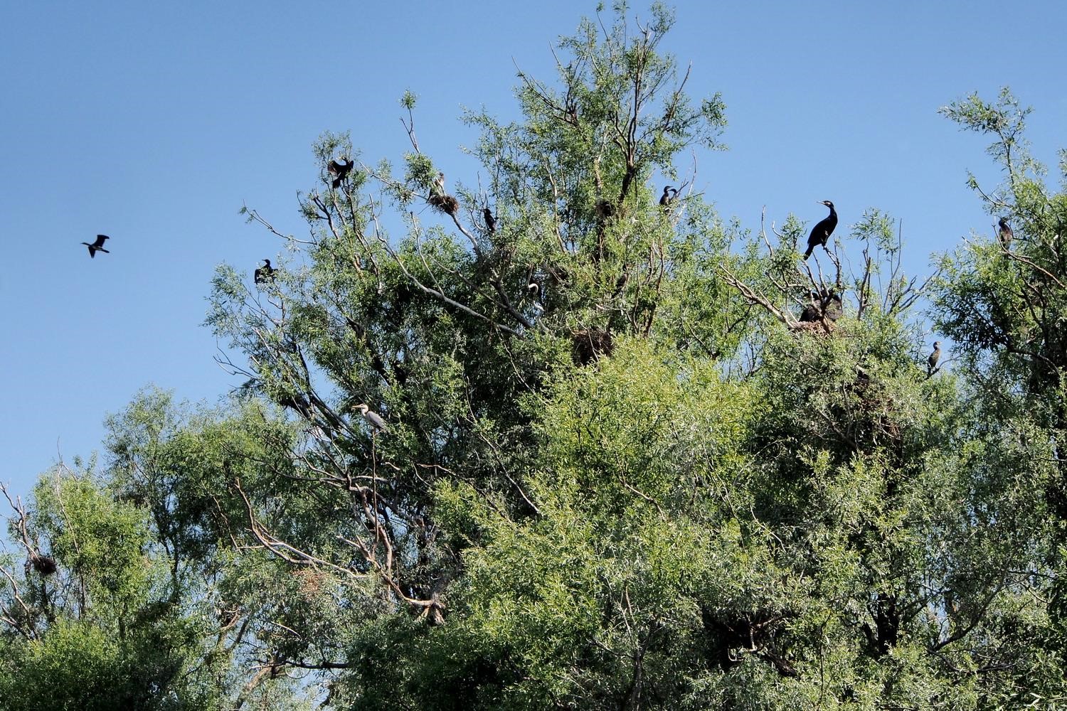
Needless to say, it is full of life. There are 312 important bird species and most of them use the Delta as an important stopover or as a breeding area. There are about 90 fish species, including globally threatened ones (for some of them this is actually the last refuge), and over 1,800 insect species.

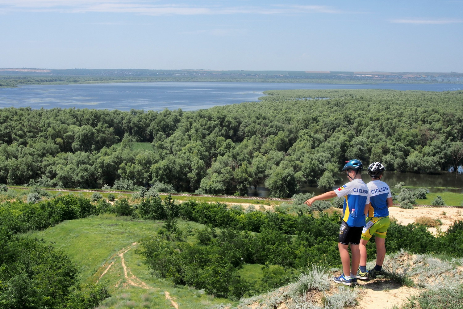
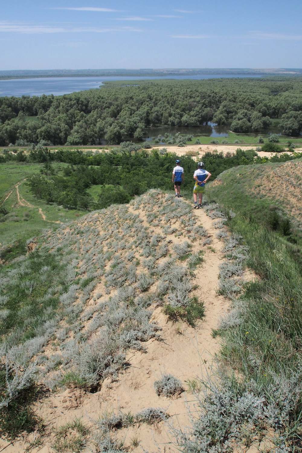
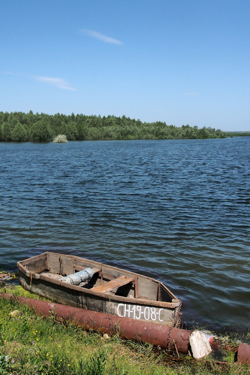
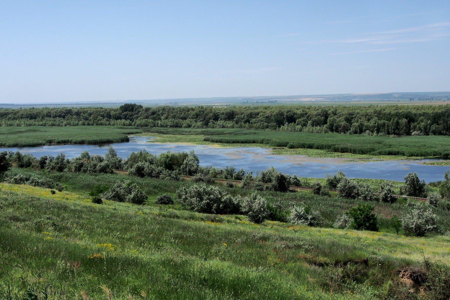
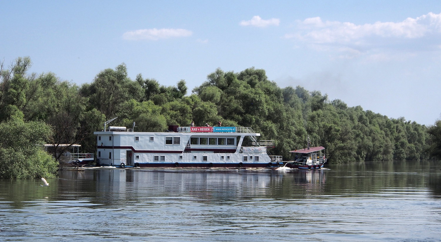
The three main arteries of the Delta are its big channels that form the basic water structure of the area. And all of them start from Tulcea: Kilia (Ukrainian), Sfântu-Gheorghe and Sulina branch. Everything else is entwined between these three final branches of the Danube, of which Sfântu-Gheorghe is the oldest one. While slowly making their path through the Delta, they divide into many smaller stream lets which end in wetlands and lakes. The river sediment mixed with the sea sand forms large sand ponds and islands. Some dunes, like those on the Caraorman sand pond, are up to six meters high and look like real desert dunes.

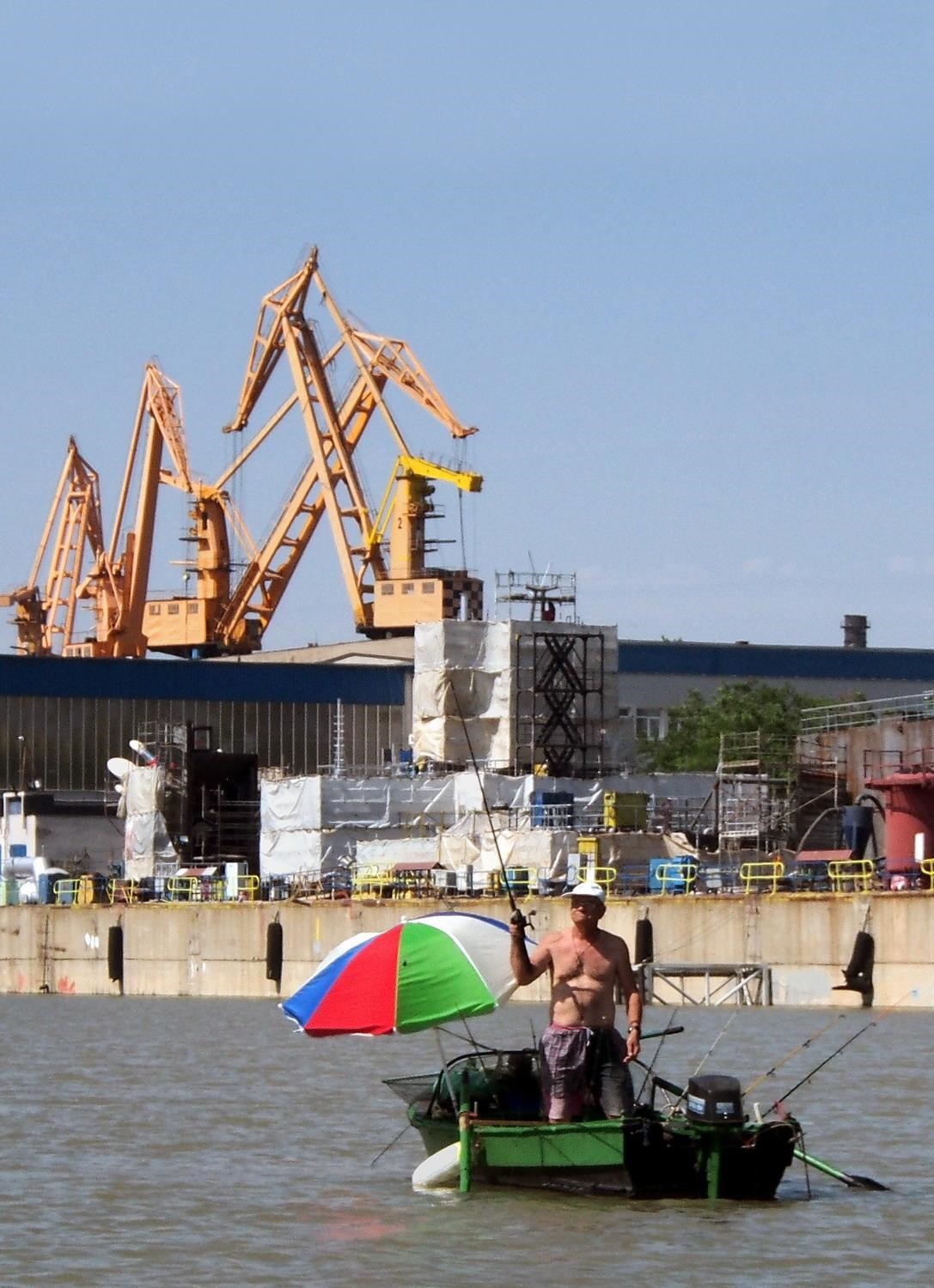
The history of the Sulina branch was shaped by pirates and clogged with shipwrecks, then framed with Turks and Russians who fought a war there. But after the Paris Conference, it was chosen to be a major waterway in the Delta and rectification works lasted from 1862 to 1902. The branch was shortened from 103 km to 70 km by cutting through its six meanders. The town Sulina became Porto Franko of Romania and was chosen in 1952 as a seat of the Danube European Commission (many see it as a forerunner of the European Union).


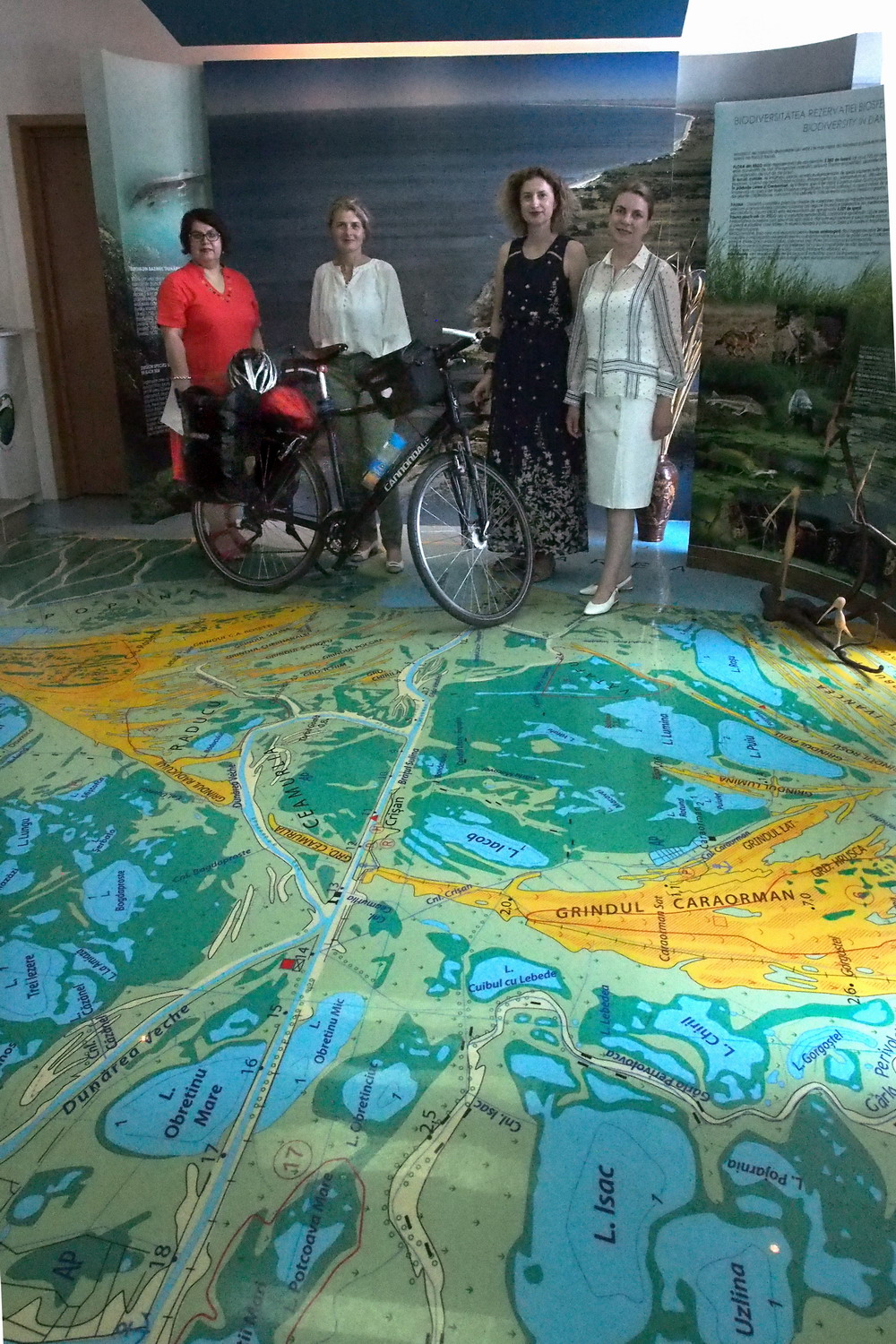
In the Visitors Center of DDBRA with two Gabrielas and two other
project managers, Mrs. Liliana Ivancenco and Mrs. Alina Codreanu.
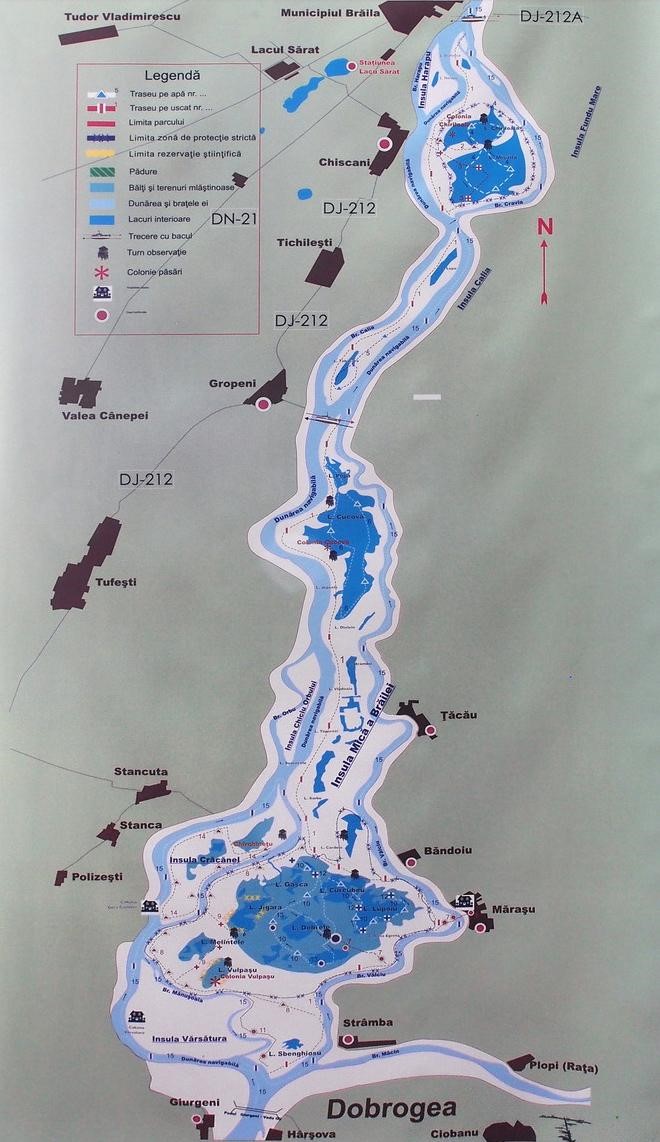
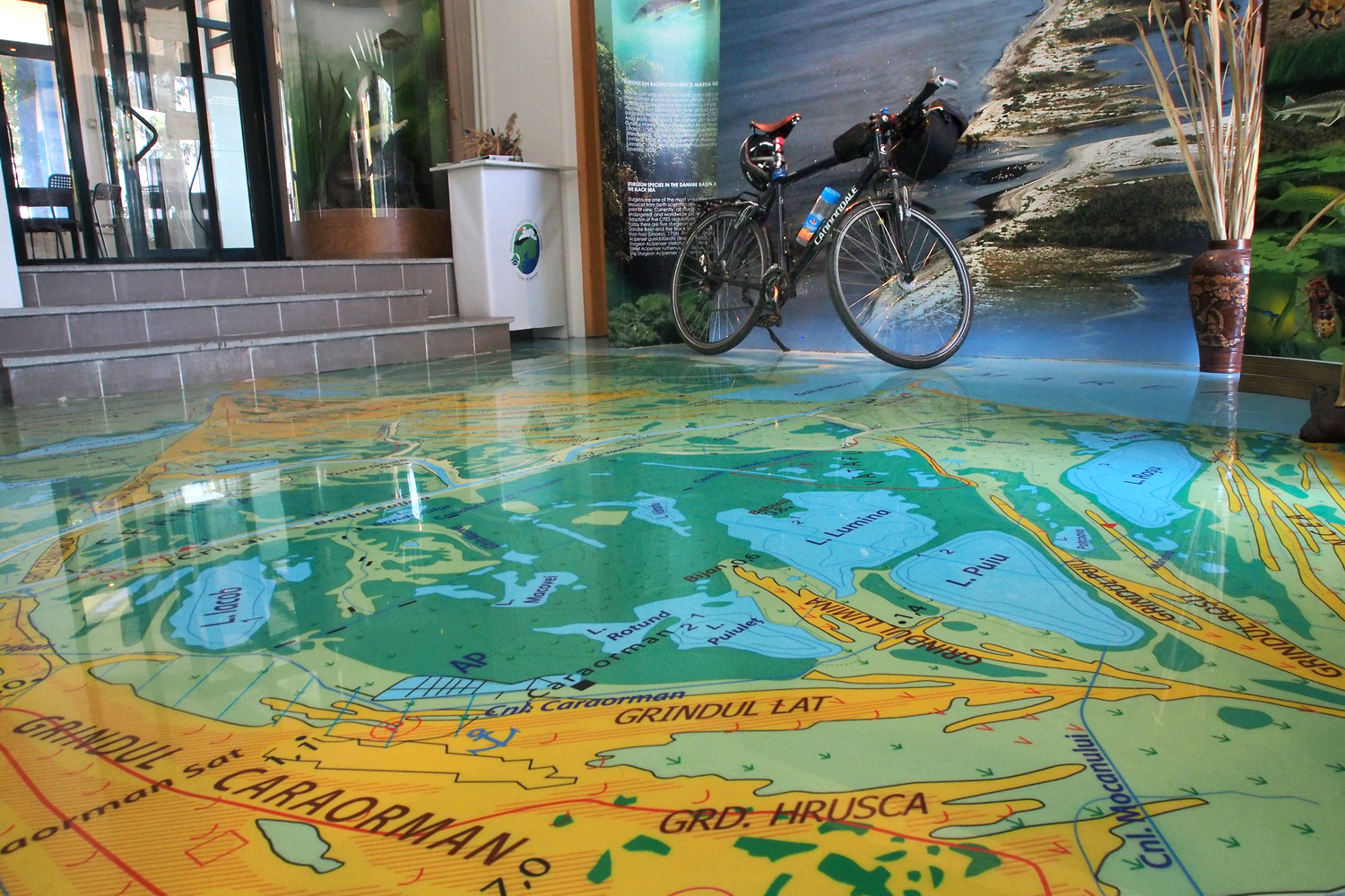
I wanted to take home this absolutely stunning map of the Delta,
but for some reason they didn’t allow me to damage the floor.

Romanian partner in the project DanubeParksConnected is the Danube Delta Biosphere Authority (DBRA). So their head office and Visitors Center in the middle of the Danube promenade in Tulcea was my starting address. My hosts and guides for the next two days were The Two Gabrielas :) - Mrs. Gabriela Creţu (Project Manager) and Mrs. Gabriela Morozov (Assistant Manager). They introduced me to the basics:

“We are a public institution, subordinated to the Ministry of Environment and founded in 1990, at the same time when the Danube Delta Biosphere Reserve was established. Our responsibility is administering, protecting and conserving the natural heritage of national interest, as well as physical and geographical units in the Reserve. 

This includes establishing (together with state authorities or independently) regulations and controlling navigation and access on the Delta branches and inner lakes for all kinds of vessels. We also support and encourage sustainable use of natural resources. And finally, we offer management, education, training, and other services.

The Visitors Center is a reach source of information on what to see and do in the Delta, and besides other material offers our Guide of the Touristic Routes, which describes 19 aquatic routes.”

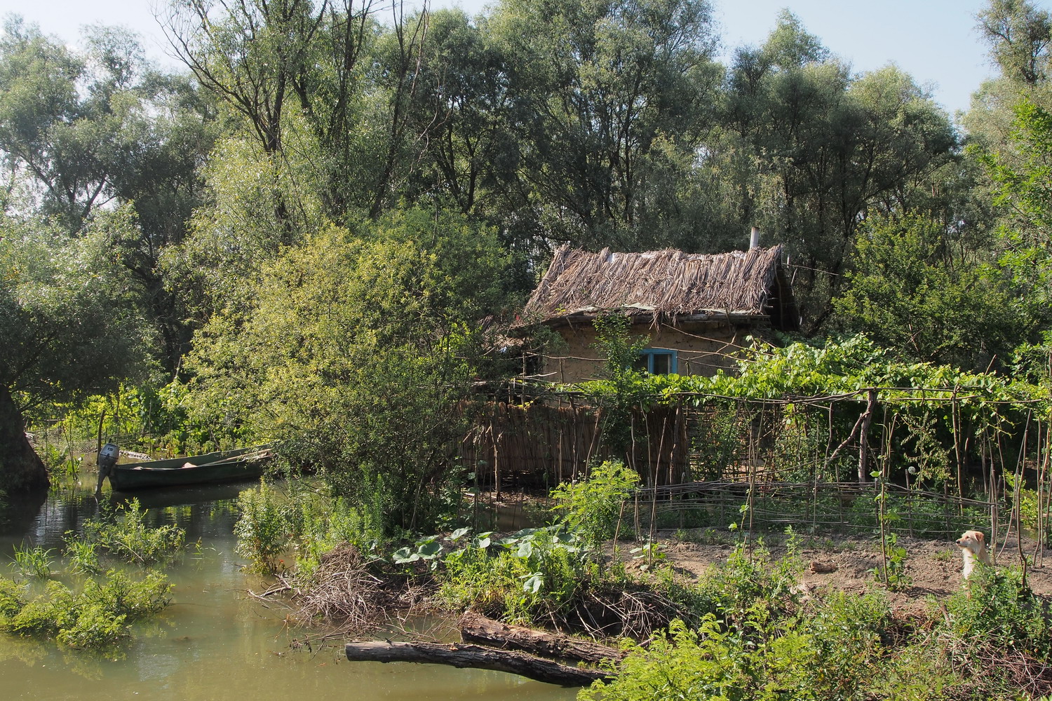
The cultural heritage of the Danube Delta is defined by the fascinating mix of Romanian, Gagauz, Lipovan, Moldavan, Russian, Ukrainian, Bulgarian and Turkish people who live their hidden lives scattered around in tiny villages. In recent times tourism appears as a new important economic activity after traditional fishing, hunting, reed harvesting, livestock raising, and modest agriculture.

“The population of the Delta (including Sulina with its 2000-3000 inhabitants) is 11,300. For most of them, life in the Delta is not easy. In winter, most channels are frozen - and they are the only "roads" to Tulcea. Therefore, in such times large icebreakers have first to break the ice and then ships with food and other supplies can follow them. The water level in the channels sometimes can be too low even for small boats, but the problem will be the same: how to reach Tulcea?”

The Reserve covers an area of 580,000 ha. “ The ‘Biosphere reserve’ means there are both nature protection and cultural heritage protection. There are only two or three reserves in Romania with that concept”, says Gabriela Creţu.

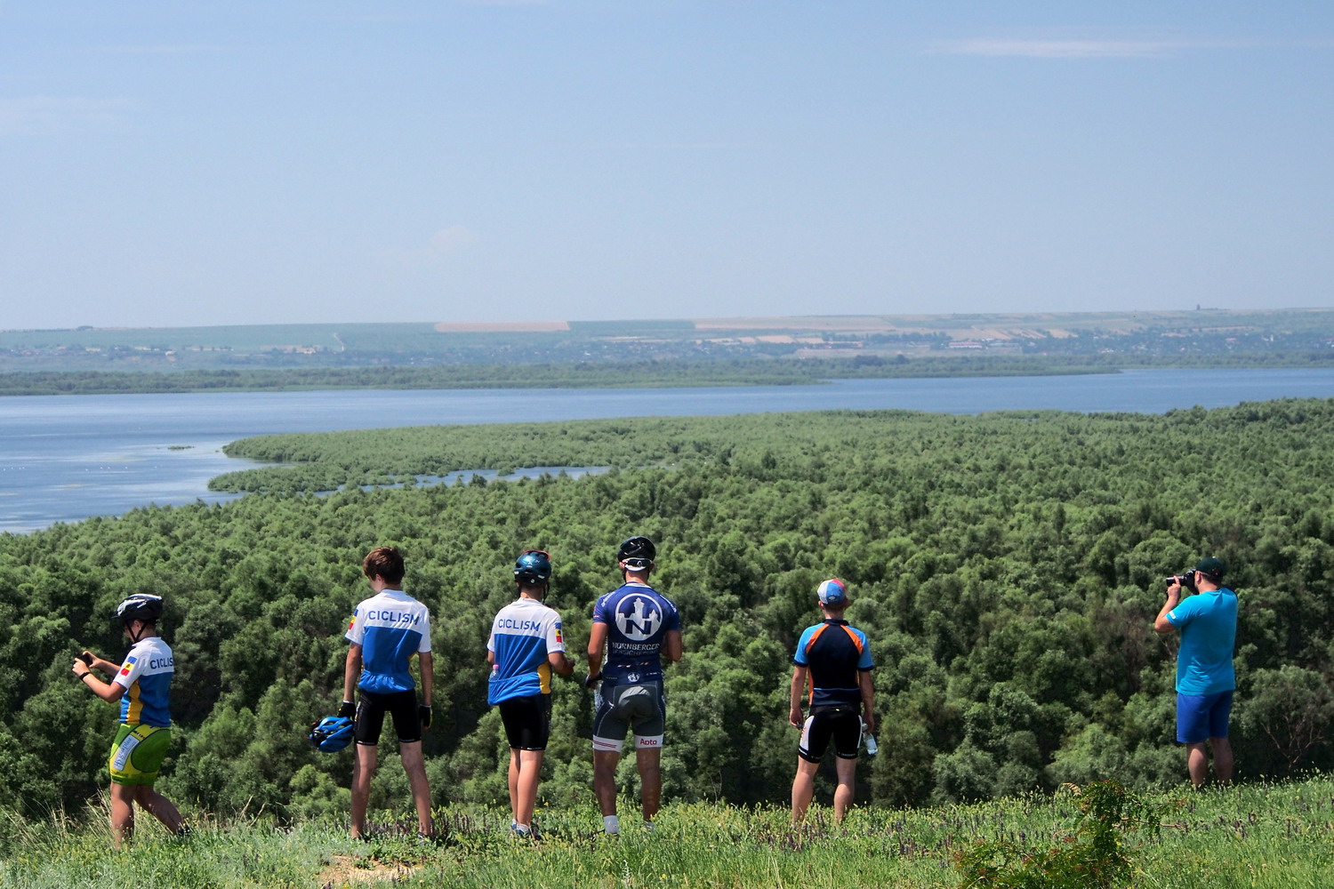
The green colour: Letea forest and the largest colony of white pelicans
in Europe. It is strictly protected and entry is allowed only with special
permission and accompanied by rangers.

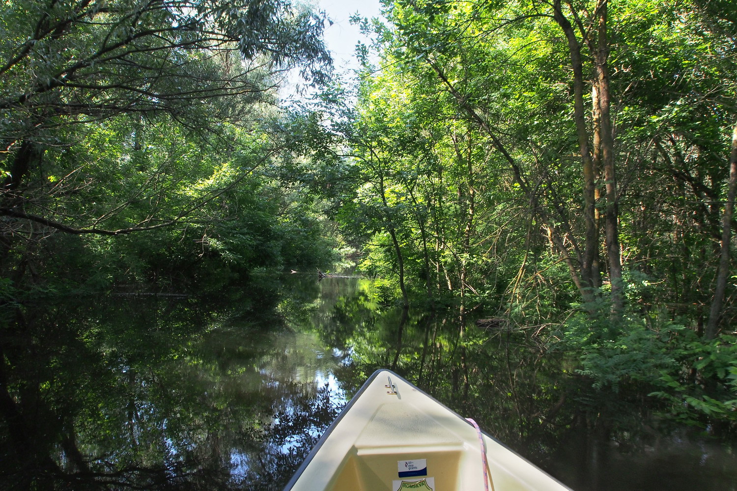
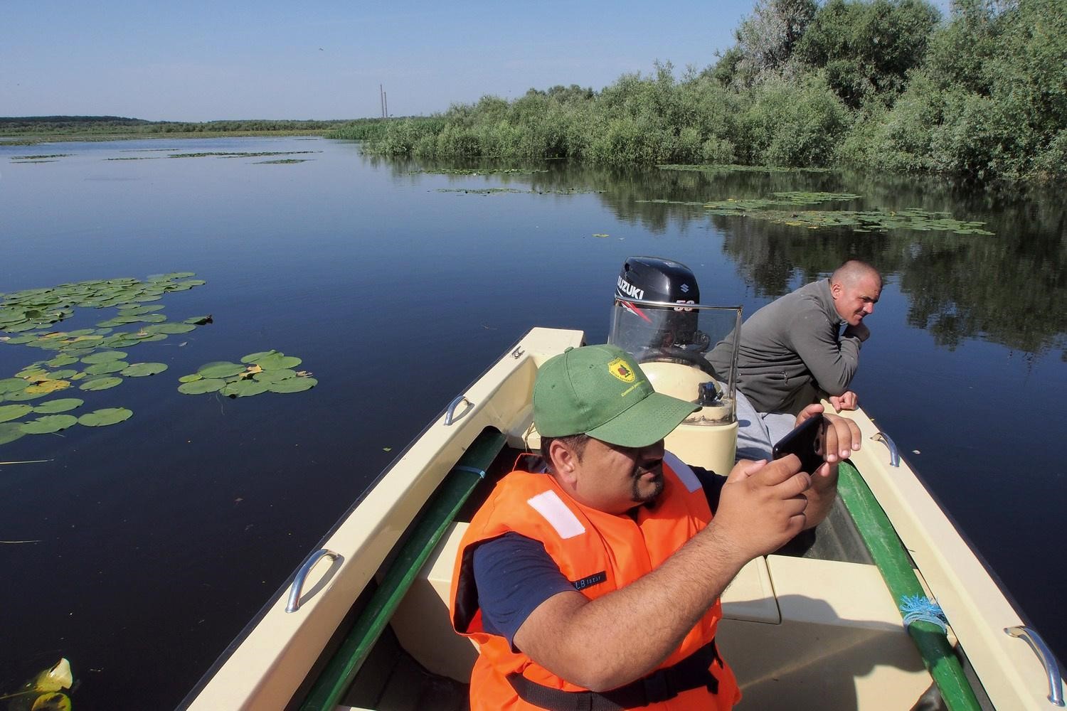
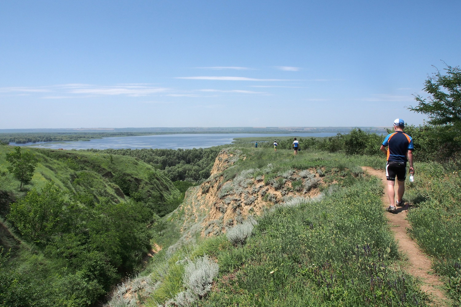
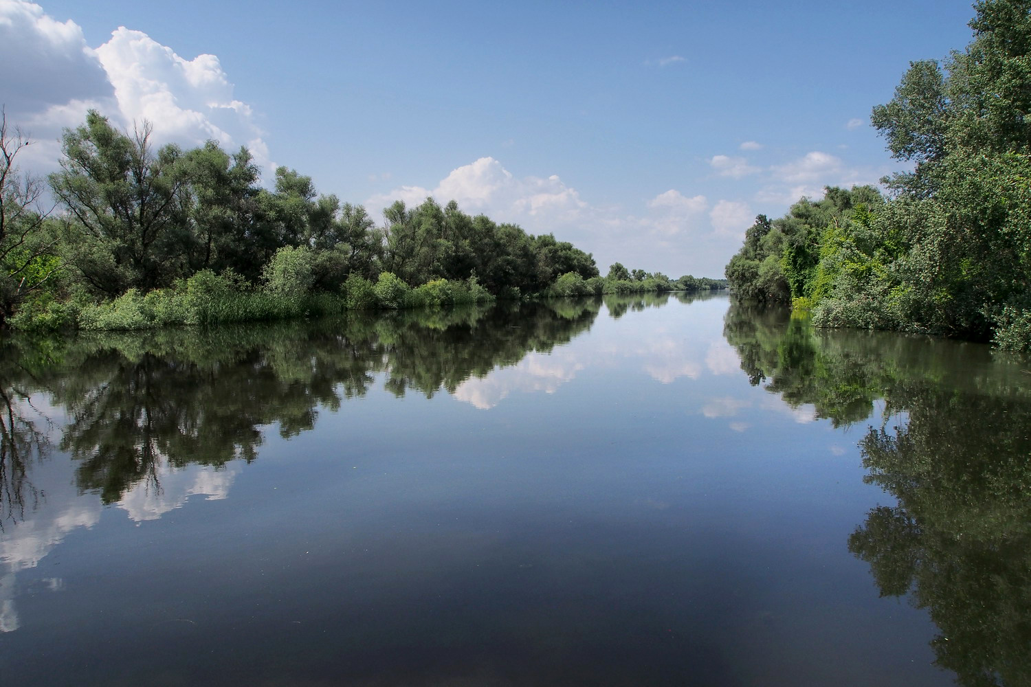
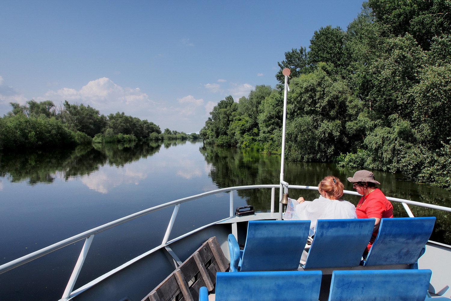
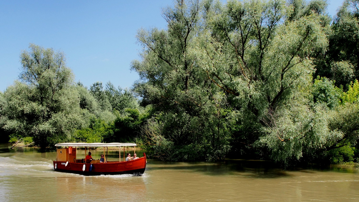
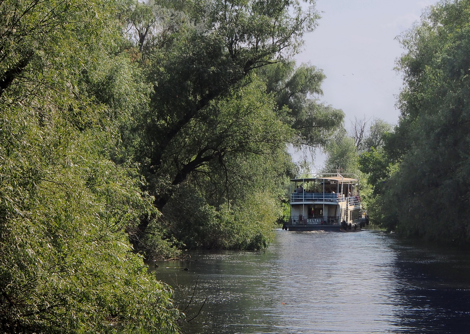
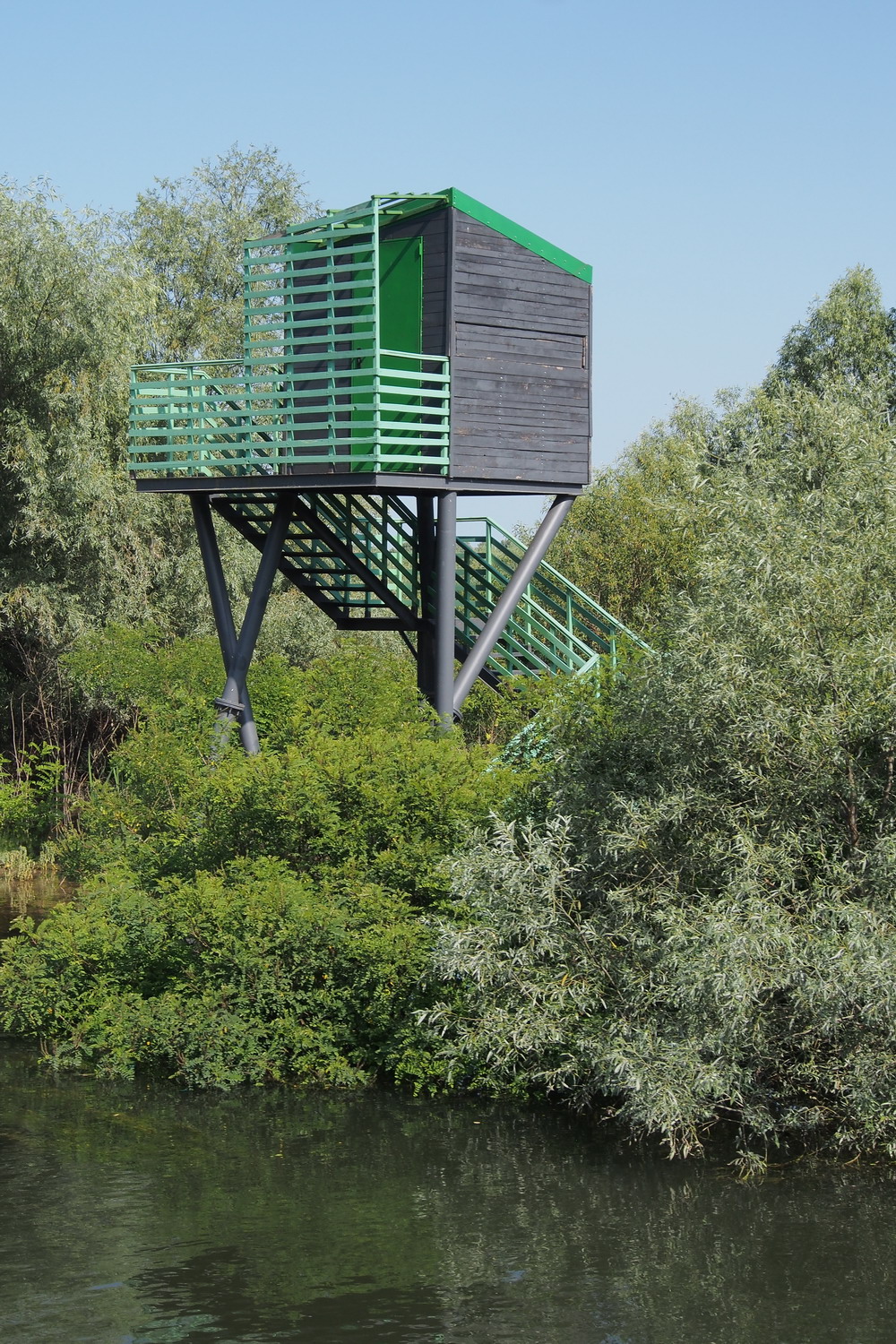
The highlight of the first day was the four-hours long cruise in the channels north of Tulcea. We went north to the Kilia branch and the border with Ukraine, then turned back.

The minimum water depth for ship navigation is 7 m and must be maintained as such. From the shore of the Black Sea to km 48 of the Sulina channel the distance is calculated in miles because this part is considered to be still a marine zone. That is how a couple of locations along the channel got their names: for example, village Mila 23 (*) is located 23 miles (ca. 37 km) from the mouth of the channel.

(*) By the way, this tiny village that is lost in the endless greenery of the Delta is the birth place of Ivan Patzaichin (originally Russian Dabovan) and the legendary canoeist who won seven Olympic medals (four of them gold) at five consecutive Olympics (1968-1984) plus 22 world championship medals.


In a channel of the Delta

There are several main bird migration routes in Europe, but this is the one that Dalmatian pelicans use: the Delta – Bulgaria – Greece – Ukraine. LIFE project in 2006-2009 had the goal to save colonies of these birds and the area was declared as strictly protected. Two nesting platforms were built there and maintained regularly each year. It is also worth mentioning that half of all pink pelicans in the world breed in the Delta. 

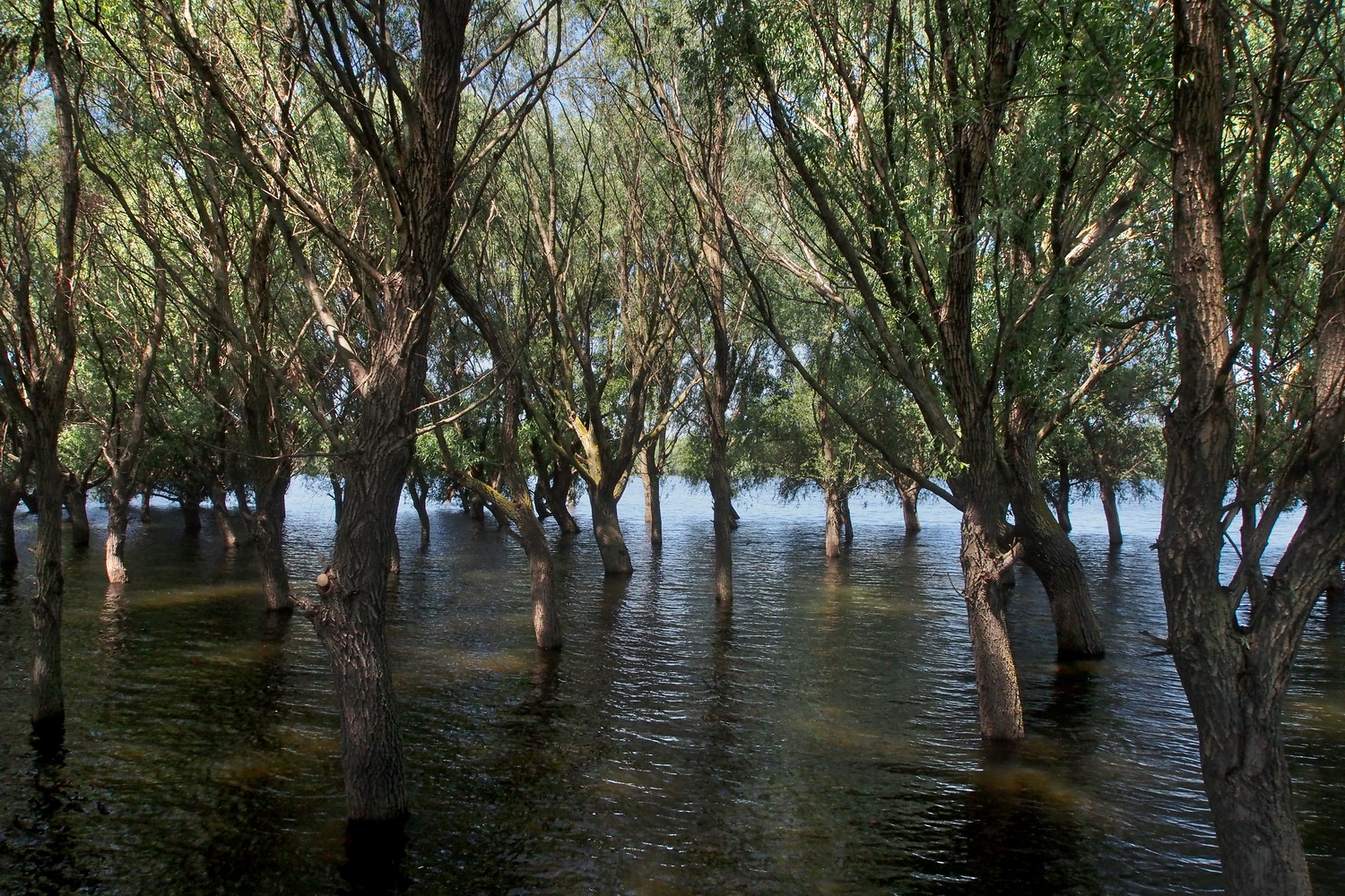
Willows prevail in more flooded areas. It is the only sort of the tree along the Danube
that can survive in the water for 2-3 months, by developing additional root network.

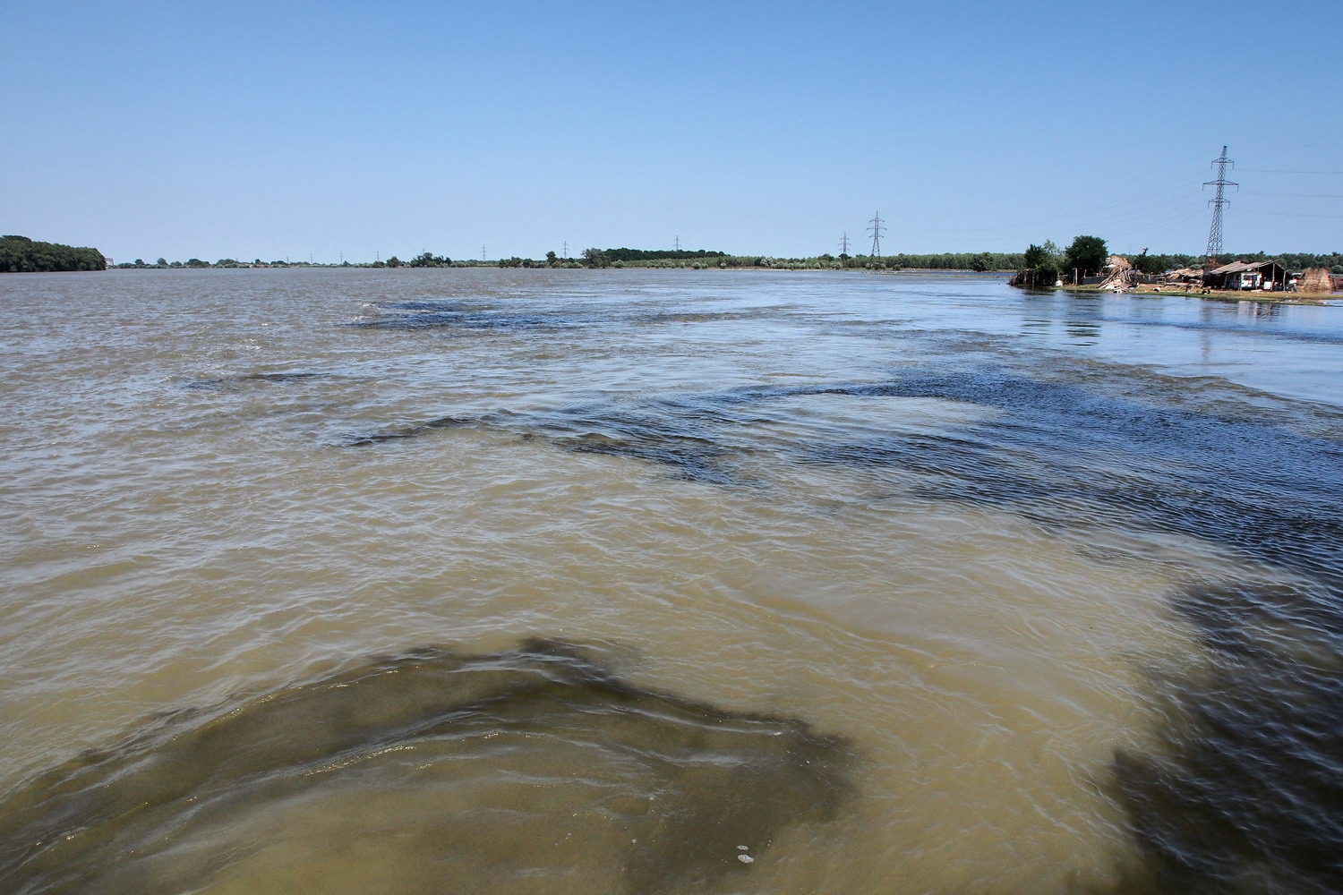
The difference in color: leaving a local channel and entering Kilia (Ukrainian) branch.

Is there poaching here? “Of course. Locals do it for centuries, but the worst pests come mostly from Bucharest and use sophisticated technology - modern boats with powerful engines, sonars… That’s why they can make a lot of damage in a short time. In order to prevent the damages, the DDBR has a special department that checks licenses of fishermen sighted on the spot.”


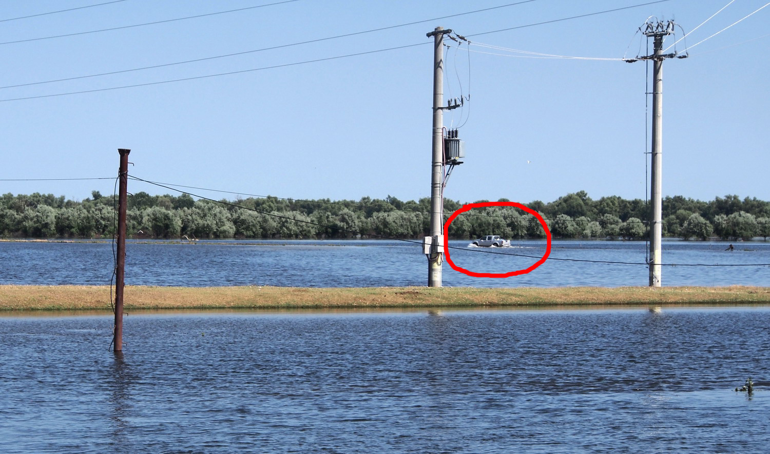
A bit of magic: when the water is high some roads disappear below the surface. But for locals, driving is a matter of self-confidence :)

The traffic from a side street


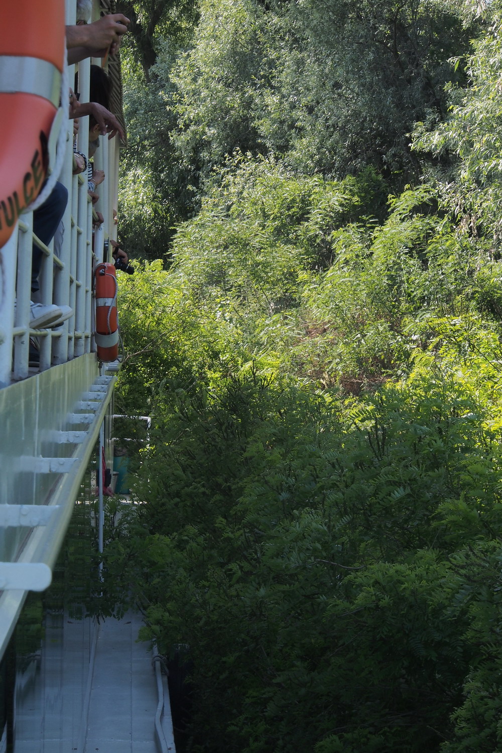
To better feel the atmosphere in the Delta channels, it is really, really
recommendable to watch movie  “Fitzcarraldo” by Werner Herzog.
It takes place in a labyrinth of Amazon channels, but scenes look exactly
like this one. Including one of the main characters – the boat :)


The next day the three of us walked to the Monument of independence on the top of the highest hill in Tulcea, to enjoy nice view of the town. Another thing one could see from there was a "mini Delta" on the nearby Lake Sagen. It was revitalized during a Romania-Ukraine trans boundary project which lasted from 2007 to 2009. Gabriela Creţu had a special feeling about it:

“It was the first project in which I participated in the DDBR.  I was engaged in the creation of a feasibility study and technical documentation. Tulcea City Hall then started corresponding works, using EU funds for infrastructure and environment development. From 2009 to 2010, unsightly cottages around the lake (some kind of slum) were removed and birds then returned to the lake. We call this complex "mini Delta" because it has characteristics of a model, with its small channels and ponds, just like the real Delta. It receives water through a canal that connects it to the Danube and the water level is regulated by a sluice.

The lake is not open to the public yet. According to the terms of the project, five years after its completion the only allowed activity is monitoring. We will probably make it available to the public after that period but for the time being, some festivals are being held on the perimeter of the lake, and at one spot the Municipality has reconstructed a typical fishing village with several houses.”

Lake Sagen

There are only a few masters (so-called „marangos”) nowadays who can build traditional boats of the Delta fisherman. The last one in Tulcea cooperated with above mentioned Ivan Patzaichin in designing an innovative combination of boat and canoe, “canotka”. They now offer to tourists a small fleet of these boats and organize a race for fishermen, amateurs and children on the Lake Chiuperca on the Day of the Biosphere Reserve (September 1st). They also organize a triathlon and provide camp for visitors during the annual Pelican Festival (what a great name!) of ecological documentary movies.


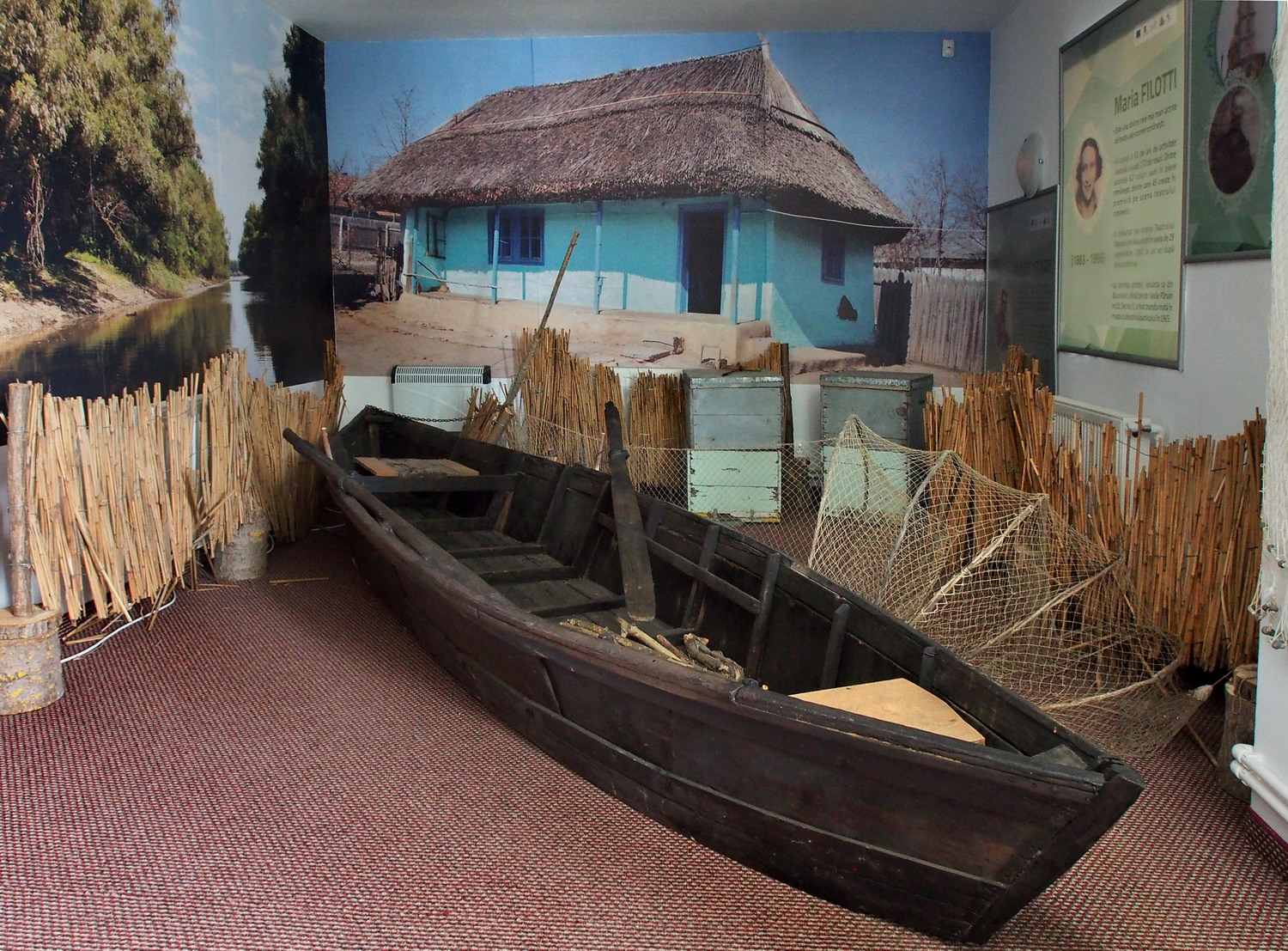
Below the hill, in the old Lipovans' quarter, there is a very interesting Ecotouristic Museum "3D Delta–Dobruja–Doborogea". Mrs. Christina Dinu, the director at the museum, took us around and revealed to us with many curiosities:

“There are 20 strictly protected areas in the Delta. Letea Forest was the second zone in Romania declared as a protected area, and it is an enigma for biologists because it developed on the sand. (By the way, it is worth mentioning that generally virgin forests of Romania are found in the Tulcea County.)

The Delta was formed over two geological periods and was influenced by two main factors: the Danube and the horizontal currents of the Black Sea. One result of that is also that we have here our own version of the Great Barrier Reef: it is a Sand belt, off the Delta coast.

And if speaking about the three main branches, the branch of Sfântu-Gheorghe is the oldest and the most beautiful in the Delta.

The bottom of the Delta lakes lies below sea level, and they actually don't have shores: what looks like that is just the edge of the dense vegetation. And that vegetation - reed above all - is a natural filter and retains heavy metals.”


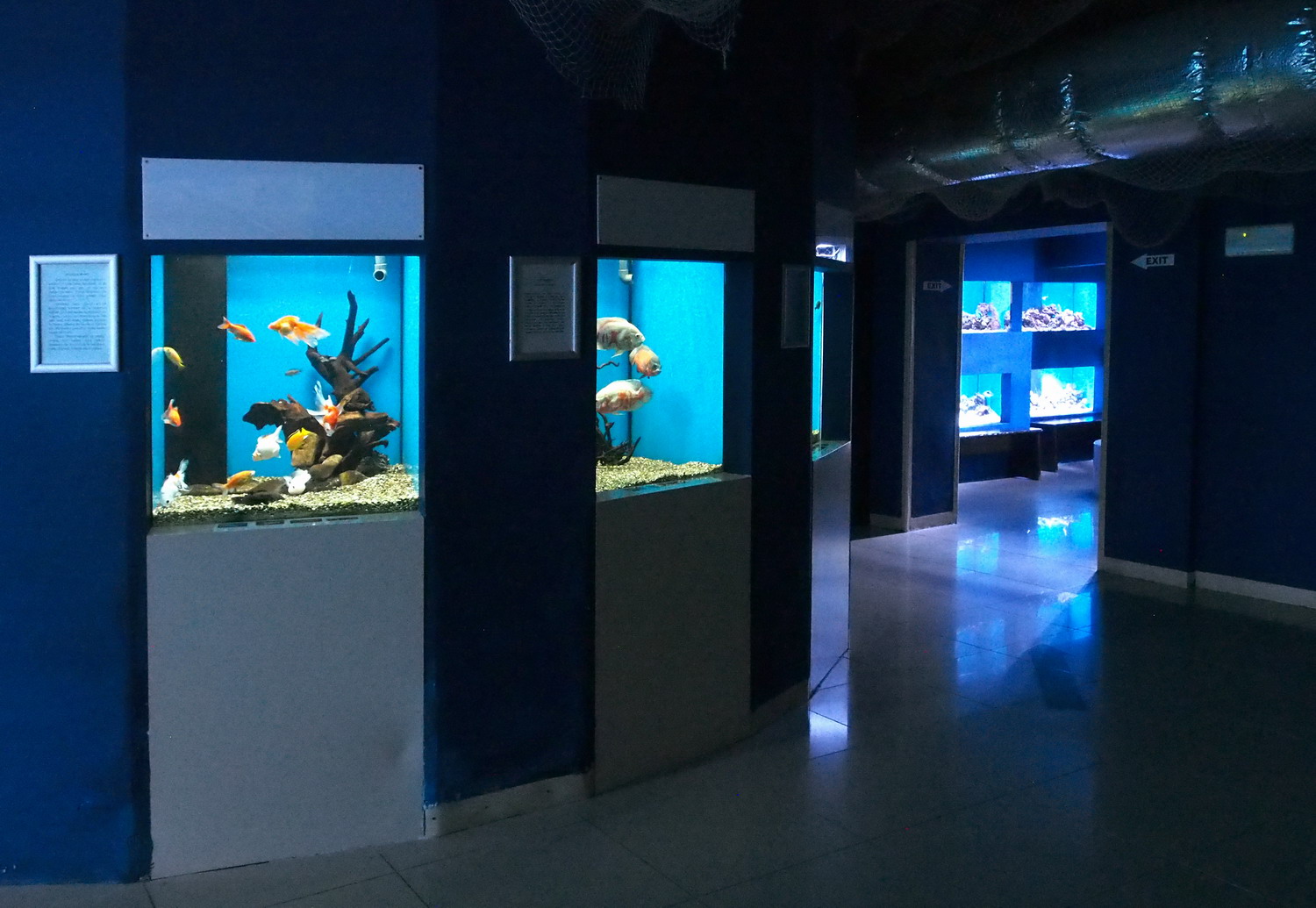
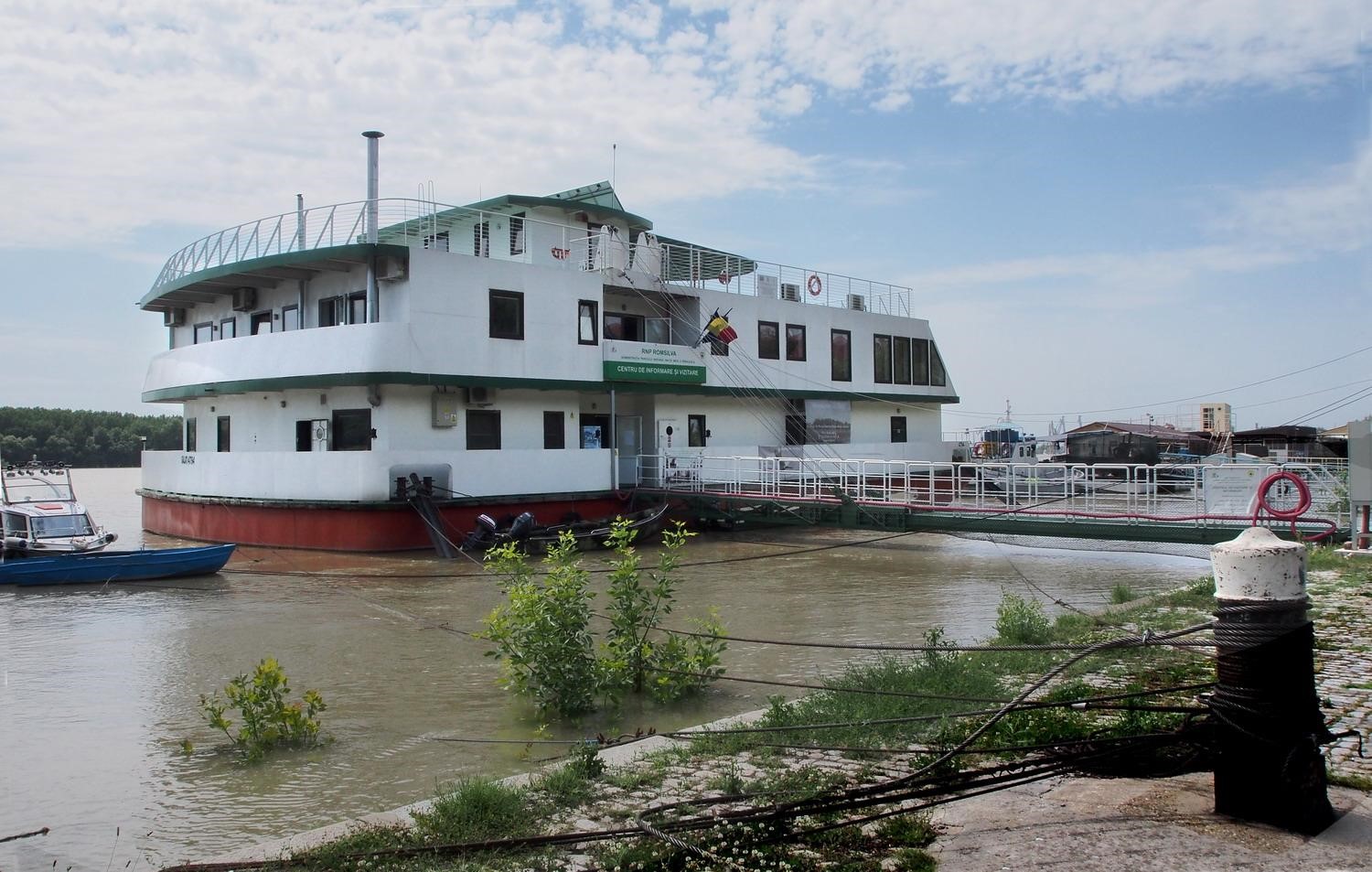
In the Ecotouristic Museum

The aquarium with sturgeons

All this green spectacle staged by the Danube wouldn’t exist without its other half, its epitome that gives the chance to incarnate into the phenomenon that we admire: the Black Sea. 

The ancient Greeks at the beginning called this residual basin of the Central European Tethys Sea Pontos Axeinos, the Hostile Sea, because of its wild storms (when the waves can reach a height of 15 m) and lack of islands. (But after colonizing its coast they changed their minds and renamed it Pontos Euxeinos - the Hospitable Sea :) About 1,150 km long and 611 km wide, it has an average depth of  1,300 m while the maximum depth is impressive 2,245 m.

During its geological history, it was a cruel mother to its children, changing the type of water from salty to fresh, then back to salty (and destroying its freshwater fauna). But because of the huge inflow of freshwater from several big rivers and semi-fresh water from the Sea of Azov, the salinity is decreasing again and now is almost 50 percent lower than the salinity of the ocean.

There are no vertical currents in the Black Sea and the quantity of oxygen decreases rapidly with depth. That’s the reason for the absence of marine life at below 150–200 m, except for a few anaerobic bacteria. Deeper that, there is also too much accumulated hydrogen sulfide.


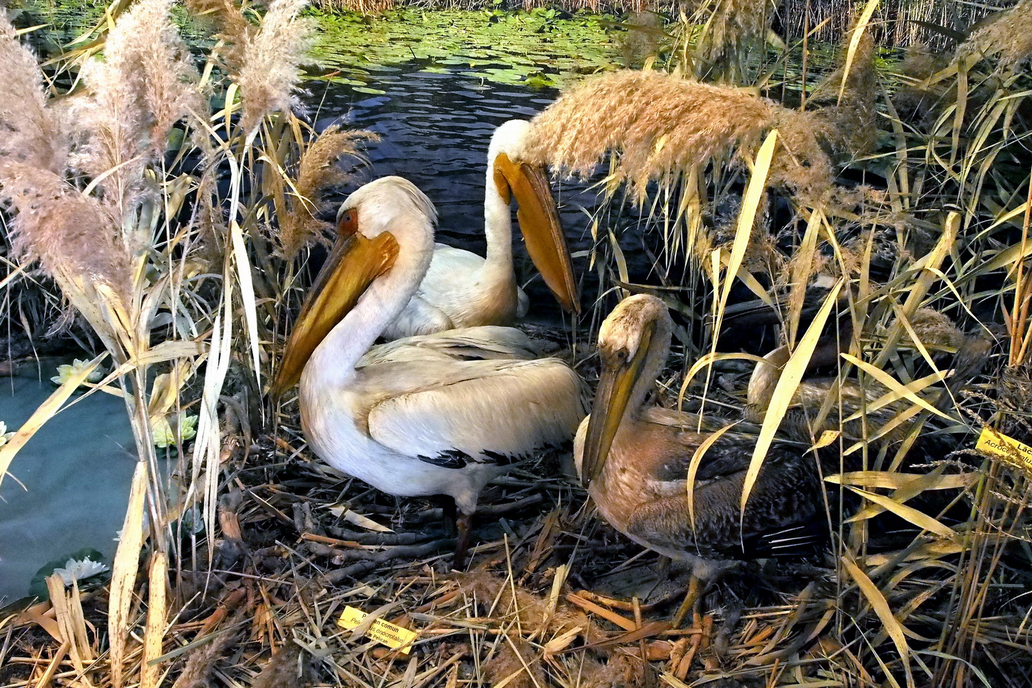
Pelicans are a symbol of the Delta and a natural monument.
One of these birds consumes six fish or two kilograms of fish per day.


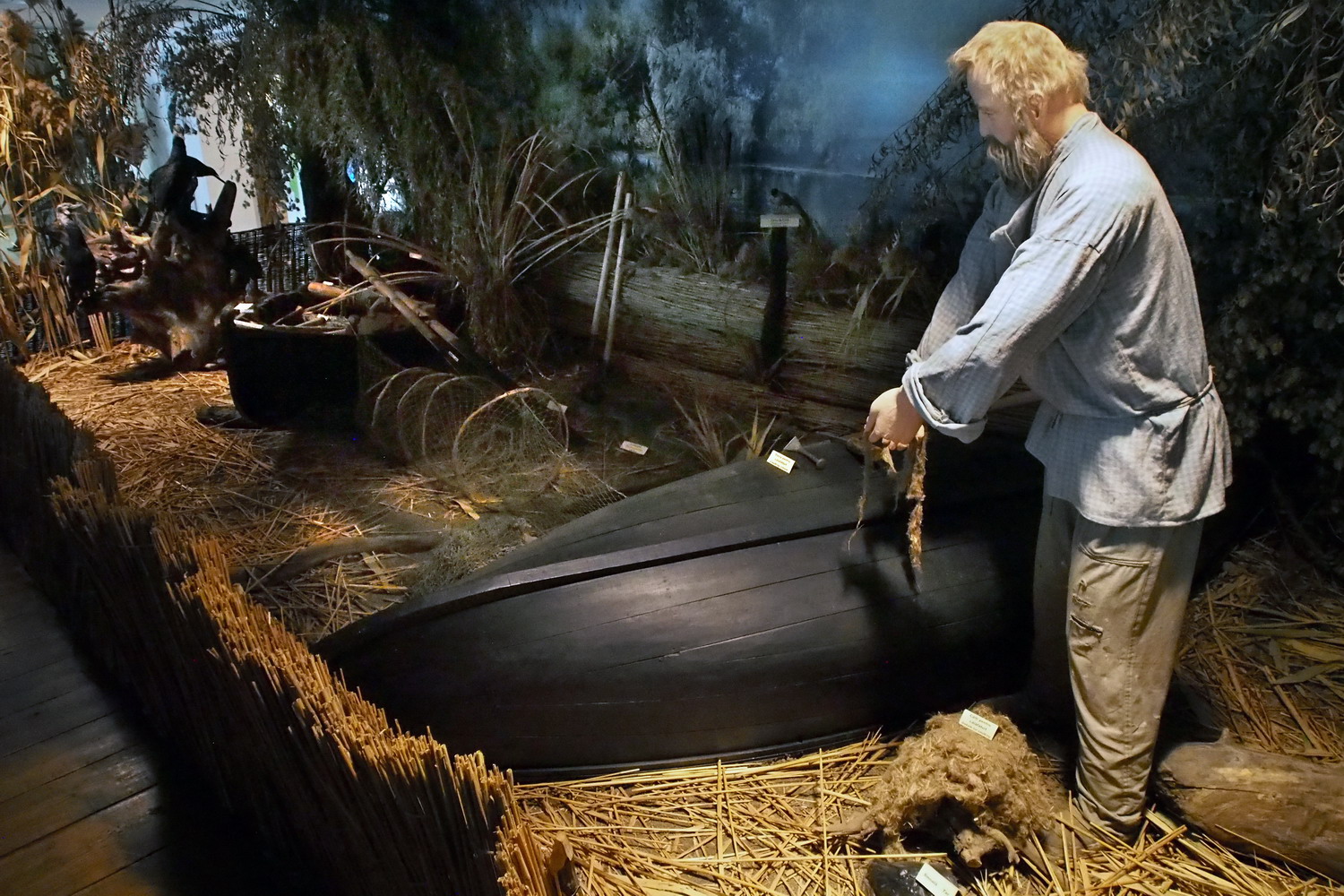
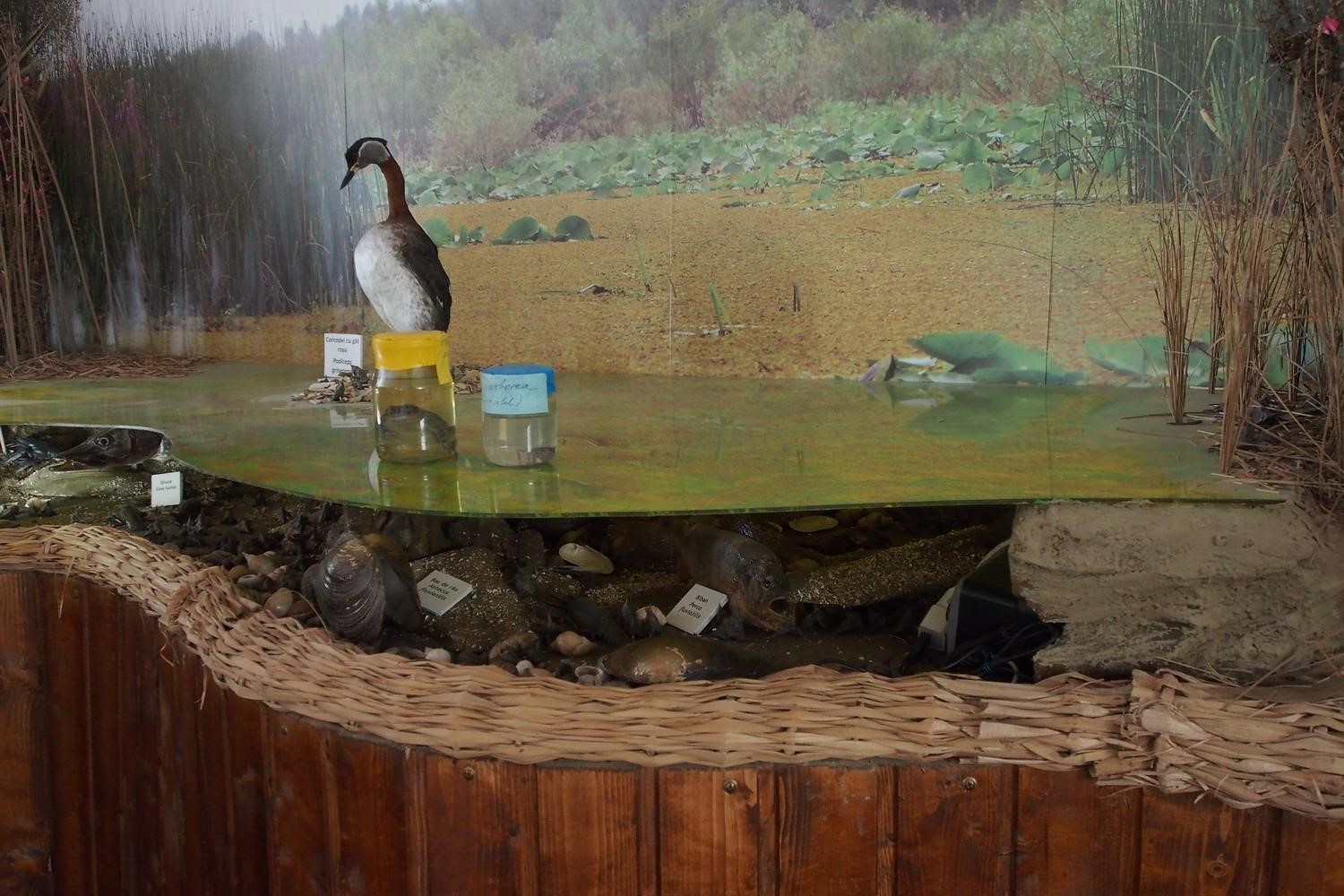
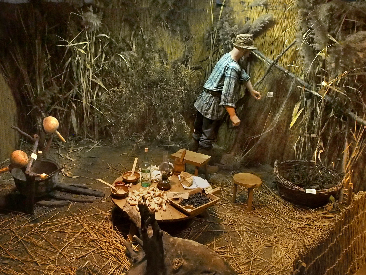
The dioramas in museum show habitats, birds and
animals, but also the traditional life of fishermen.

The museum also shows the values of the Dobruja region. It has always been strategically very important and therefore has historically been the most occupied part of Romanian territory. All five European bird migratory routes pass along that zone that offers food and rest to birds during their long journey to Africa and back. It is also the only pure steppe zone in Europe (but without typical steppe dwellers – wolfs, who are exterminated). Măcin Mountains National Park is a zone with the oldest mountains of Romania.

Argamum Citadel near Jurilovce is now the oldest settlement in the territory of present-day Romania. And there is a Greek, Roman, and Byzantine legacy in the small village of Murighiol which was at the heart of early Latin Christianity. Halmyris was a Roman and later Byzantine fort, settlement, and naval port, located 2.5 kilometers west of Murighiol, at the mouth of the Danube Delta. It is there that the bodies of the first Christian martyrs known in Dobrogea, saints Epictet and Astion, were discovered between 2001 and 2004. They preached the new religion around the year of 290 and fell victims during the persecutions ordered by Emperor Diocletian.

Tulcea is among the first spots in Romania when it comes to history and architectural values (together with Constanta).

*

The last evening of my more than two months long journey was surprisingly appropriate: Gabriela Creţu took me to a concert of classical music by the Constanța Philharmonic Orchestra. And yes, I heard there that perfect crescendo at the end of the Danube Concerto.

Programme co-funded by European Union funds (ERDF, IPA, ENI)