D2C - GIS Tool published to use benefits of the project
13-12-2021
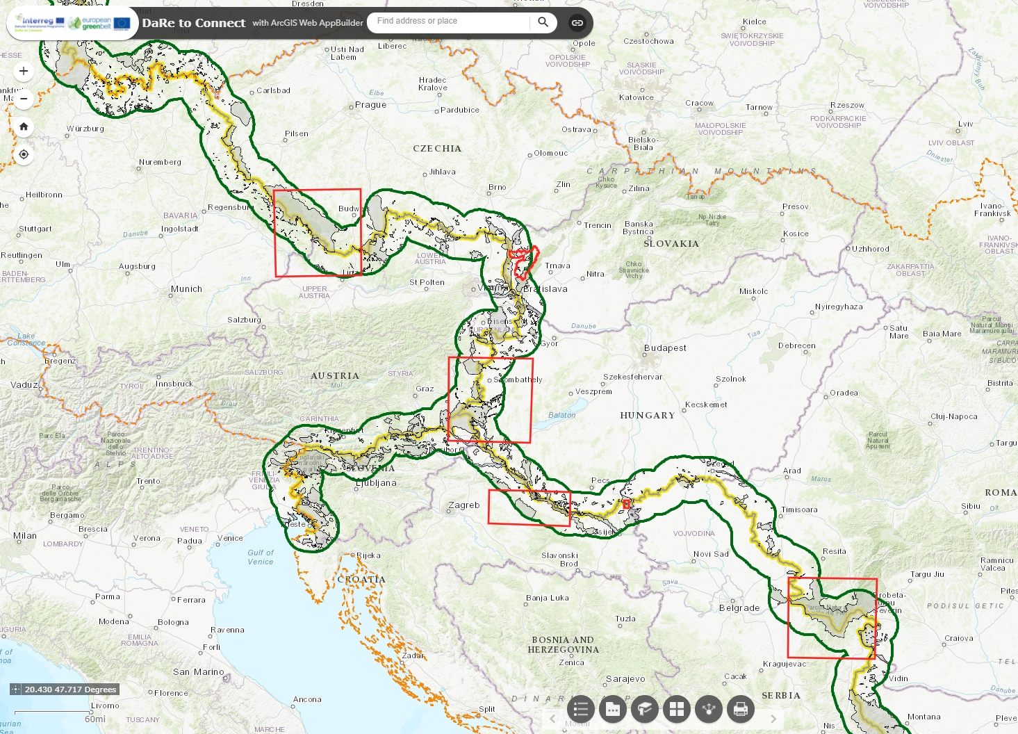
Local and regional stakeholders with the D2C Pilot regions and beyond have got the tool which help them to identify natural features and potential ecological corridors on local and regional level along the European Green Belt with specific focus on the project area. The user friendly online GIS tool takes advantage of using High Resolution Layers and Sentinel-2 satellite data to classify the Broader Habitat Types and their connectivity as well as for identifying ecosystem service provisions and by GIS data processed during the implementation of the D2C project.
Check the page dedicated to the GIS Tool to access it and learn how to use it.