DANUrB+ - PRESENTS THE ATLAS OF HIDDEN URBAN VALUES ALONG THE DANUBE
21-12-2022
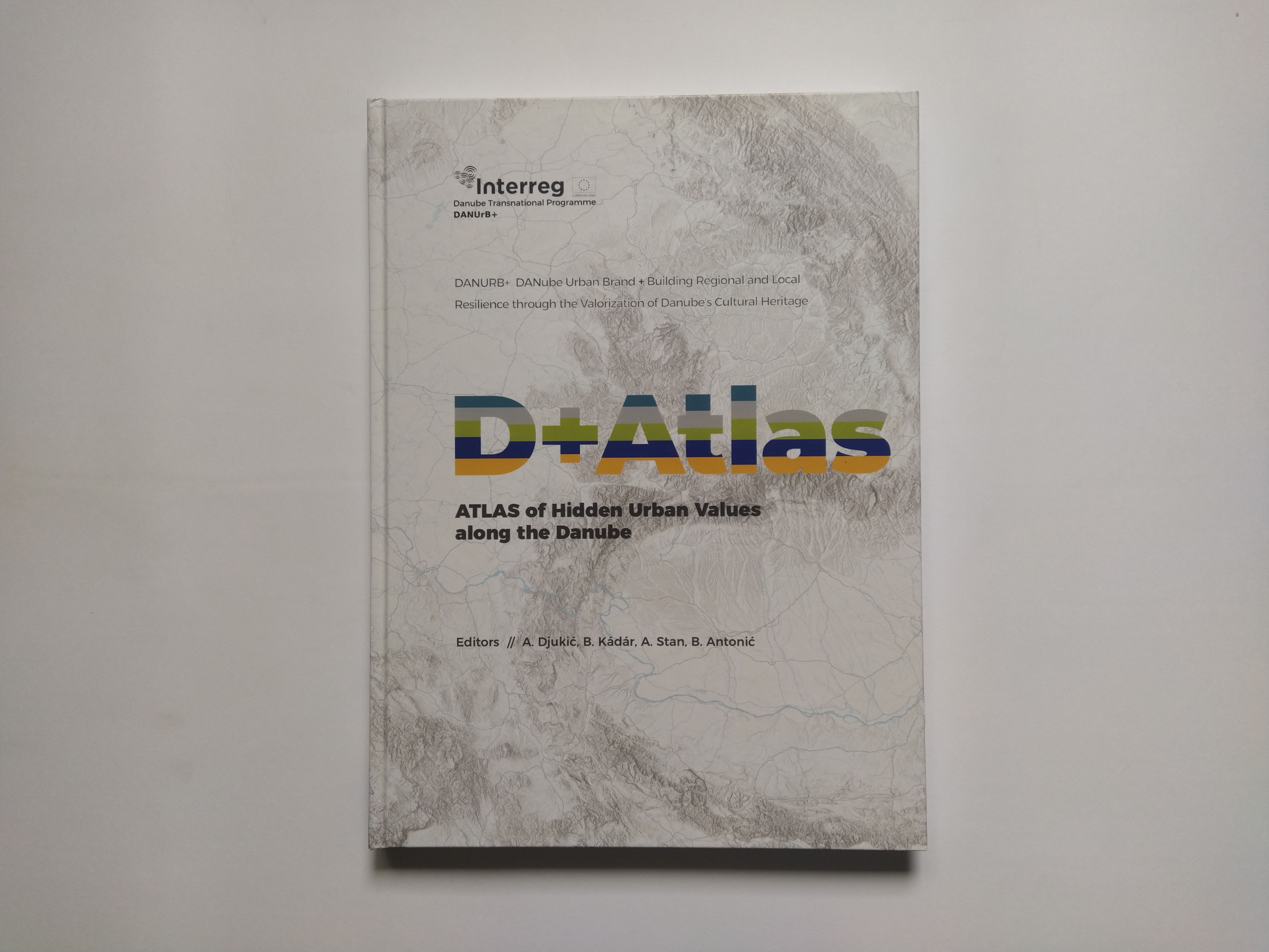
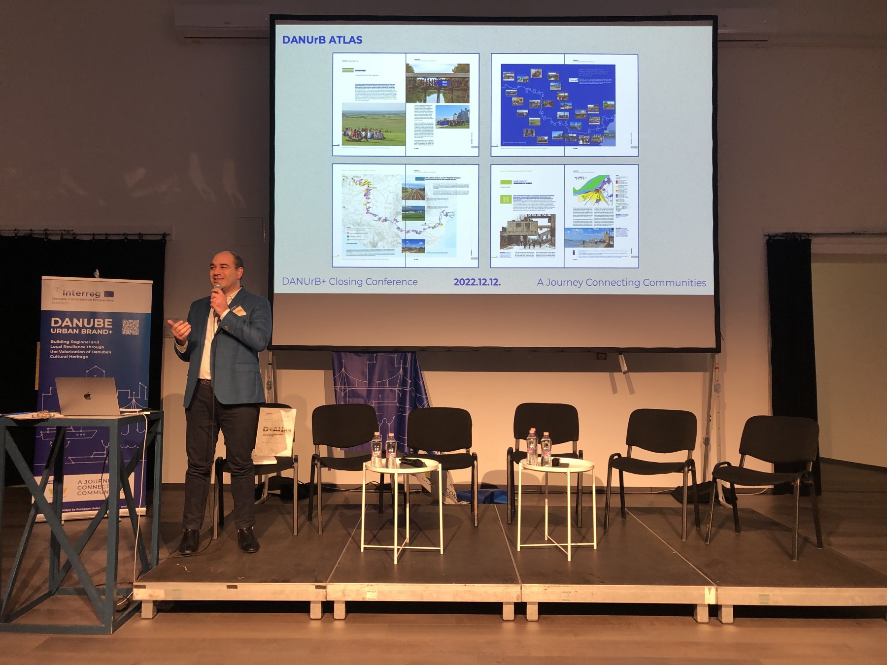
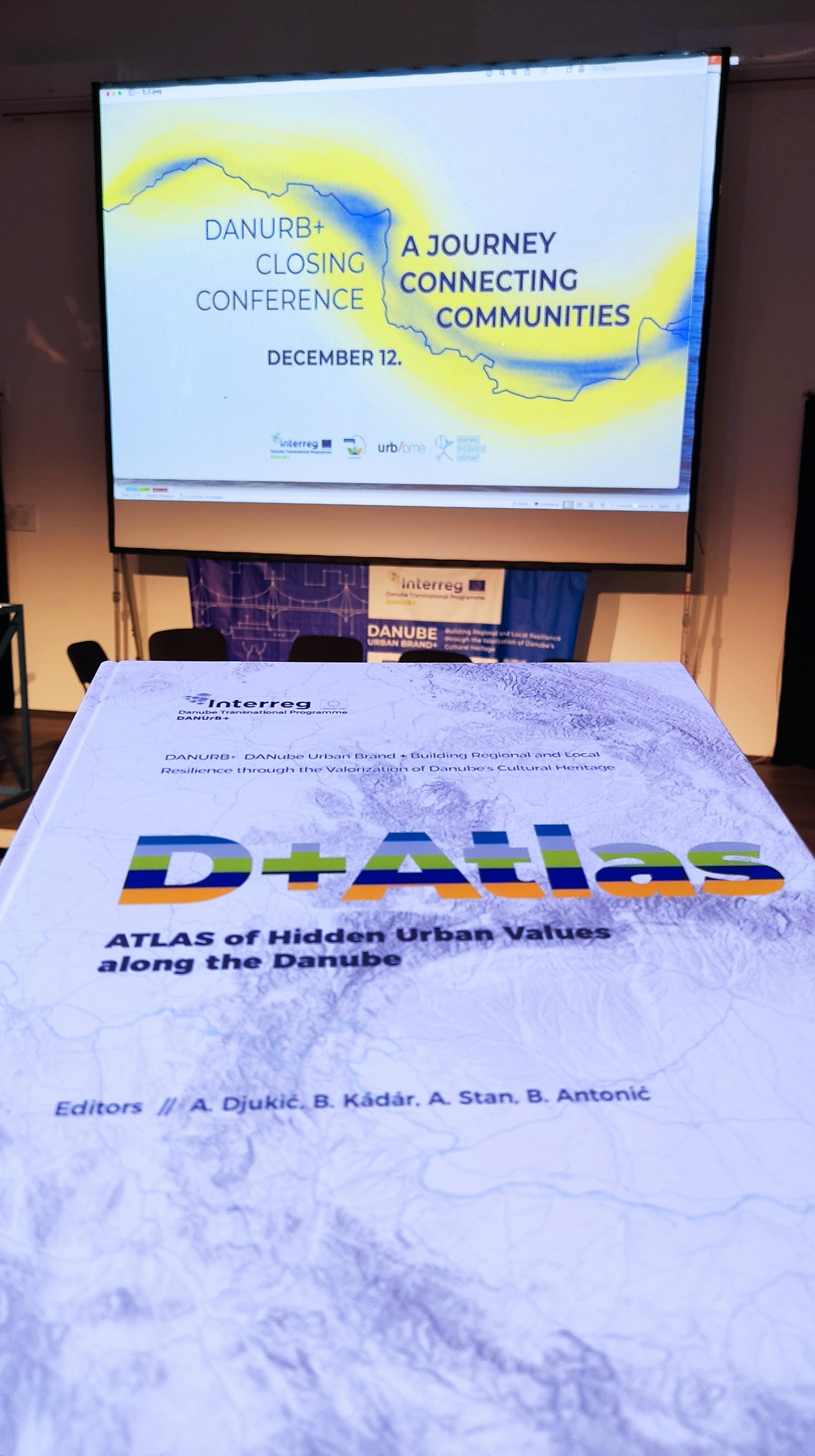
One of the main results of the DANUrB+ Project is an Urban Atlas (D+ Atlas) aiming to discover hidden urban values along the Danube. The atlas is developed as a print and digital version. First, the structure of the atlas is innovative in such a trans-Danubian context, where many areas are still not well-mapped or seen on a national level. Second, the agenda of the atlas is to embrace and promote rich albeit usually hidden urban values through maps, but also including short texts, photos, schemes, tables, and diagrams about the specificities of Danubian cities and towns and their unique urban heritage. This variety of available presenting modes means that the D+ Atlas targets a wide range of prospective “consumers”, from well-expected researchers, then citizens looking proudly for their cities and regions, to regional and local actors in heritage valorisation, regional and urban development, and the EU policymaking.
The responsible partner institution in the creation of both hardcopy and digital atlases was the University of Belgrade – Faculty of Architecture, Serbia, with the strong support from two other important partners, the leading partner Budapest University of Technology and Economics, Hungary, and “Ion Mincu” University of Architecture and Urban Planning from Bucharest, Romania. These three partners were in charge for the introductory and concluding chapters and the main atlas maps dedicated for the whole Danube Region. In addition, the other project partners from the academic sphere – Slovak University of Technology in Bratislava, Slovakia, Politehnica University of Timișoara, Romania, and New Bulgarian University from Sofia, Bulgaria – significantly participated in the most interesting cities’ case studies from their respective countries. The team members of these six higher-education institutions, plus participants from the “Josip Juraj Strossmayer” University of Osijek, Croatia, authored 15 joint chapters. The last but not the least, the other non-university project partners, as well as associated strategic partners and stakeholders from the Danube Rivershore, had their contribution through providing local stories, photos, statistical data, and participation in joint discussions on how to make this atlas more attractive for and close to local people and experts.
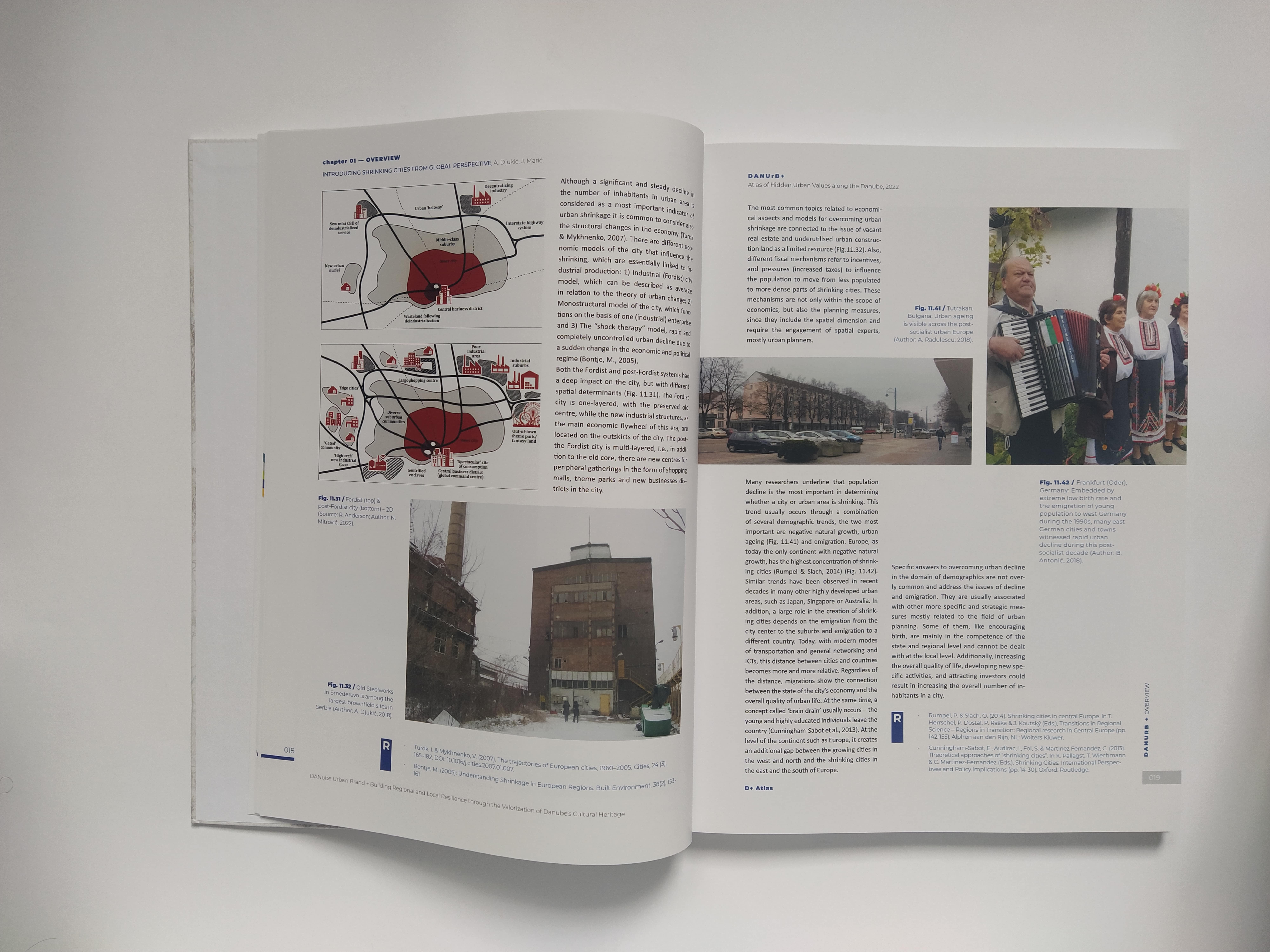
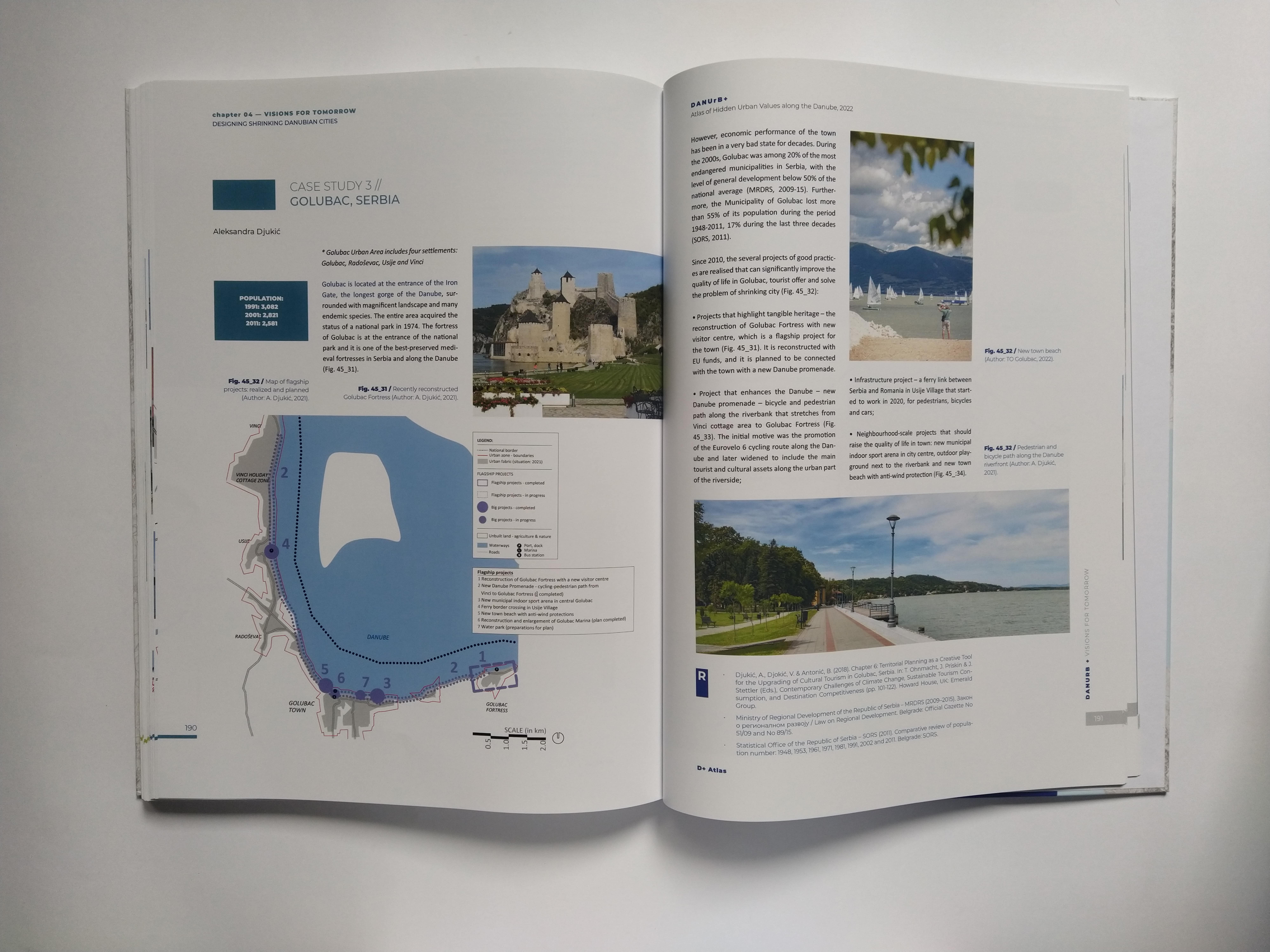
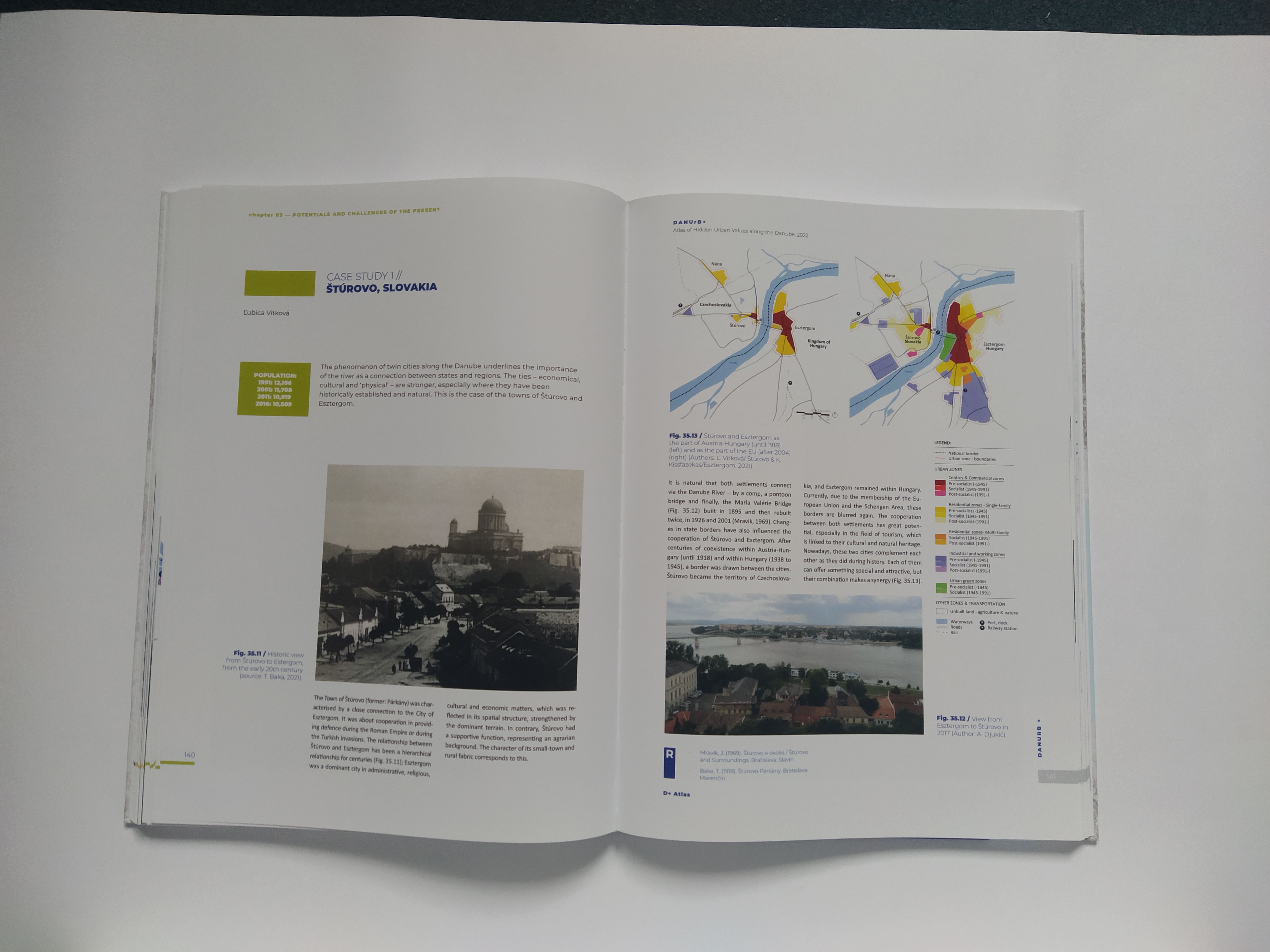
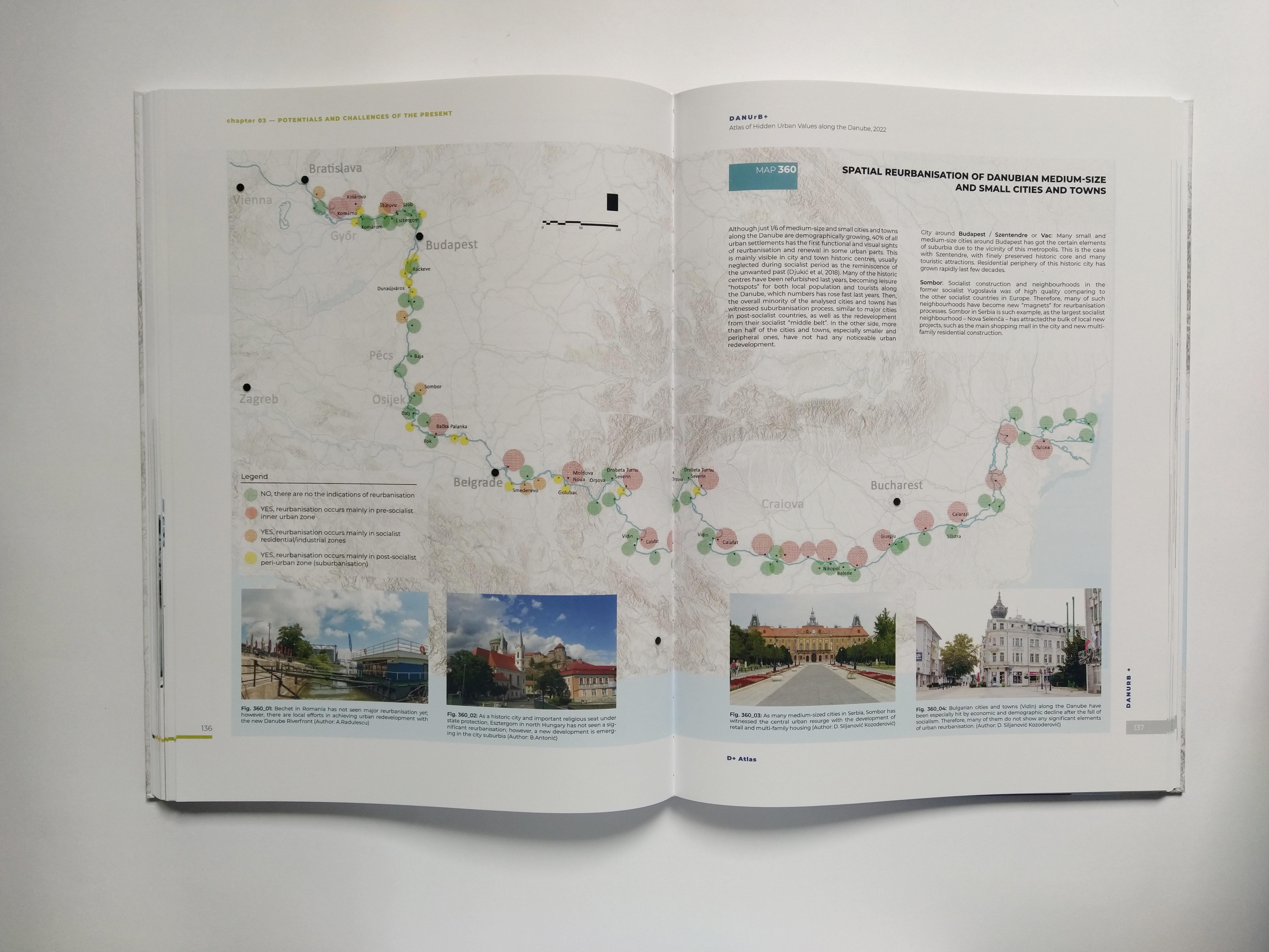
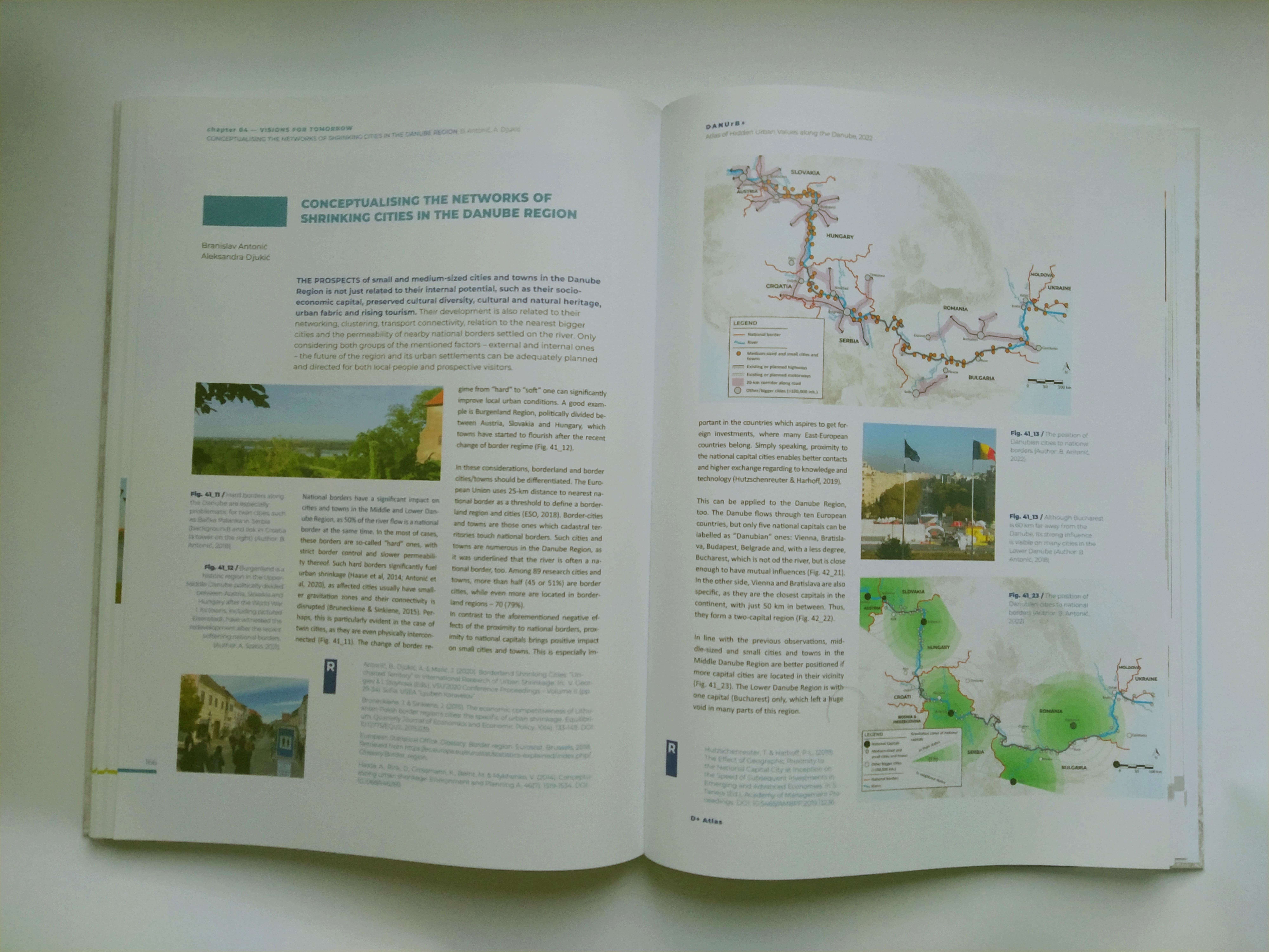
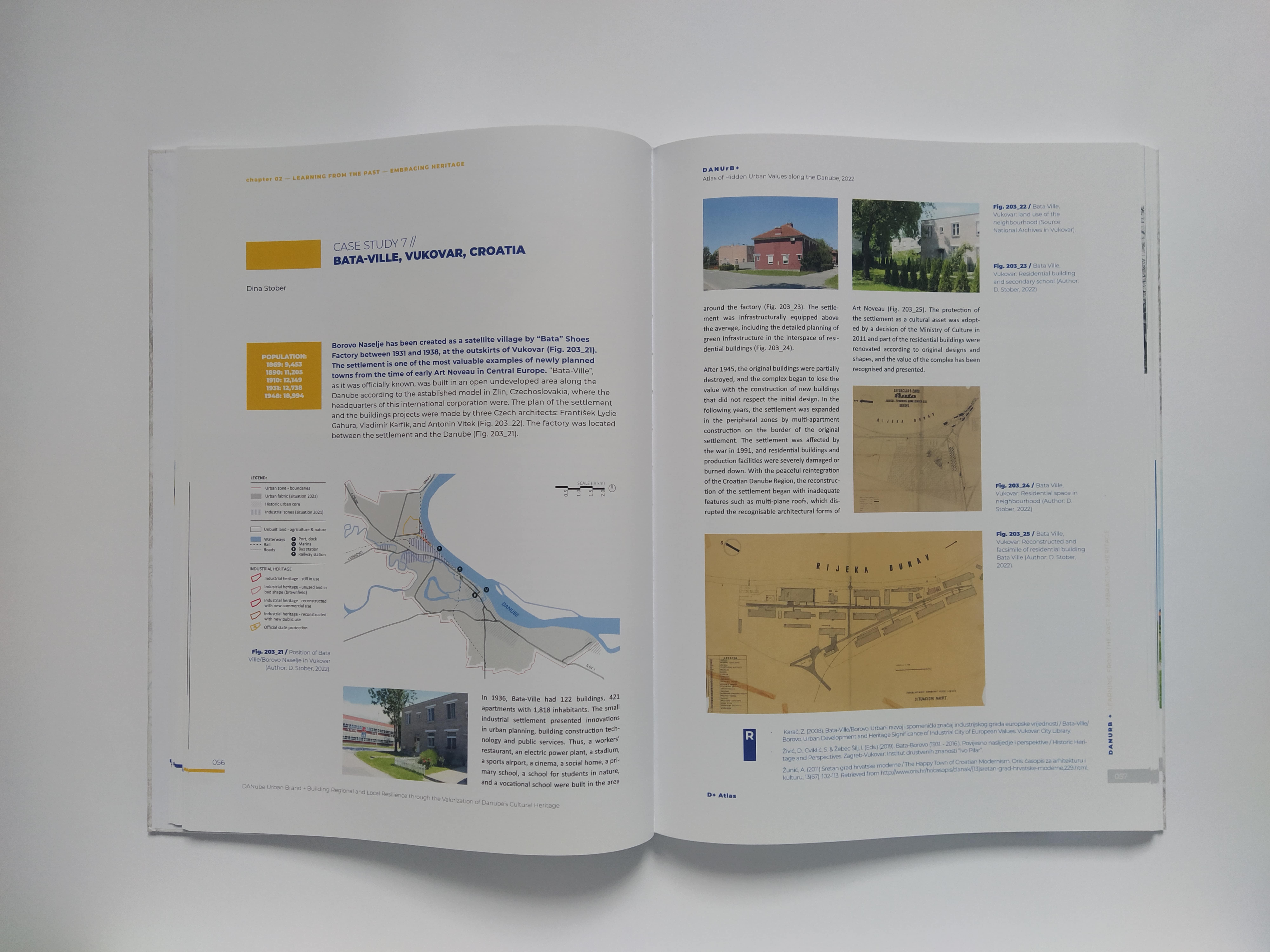
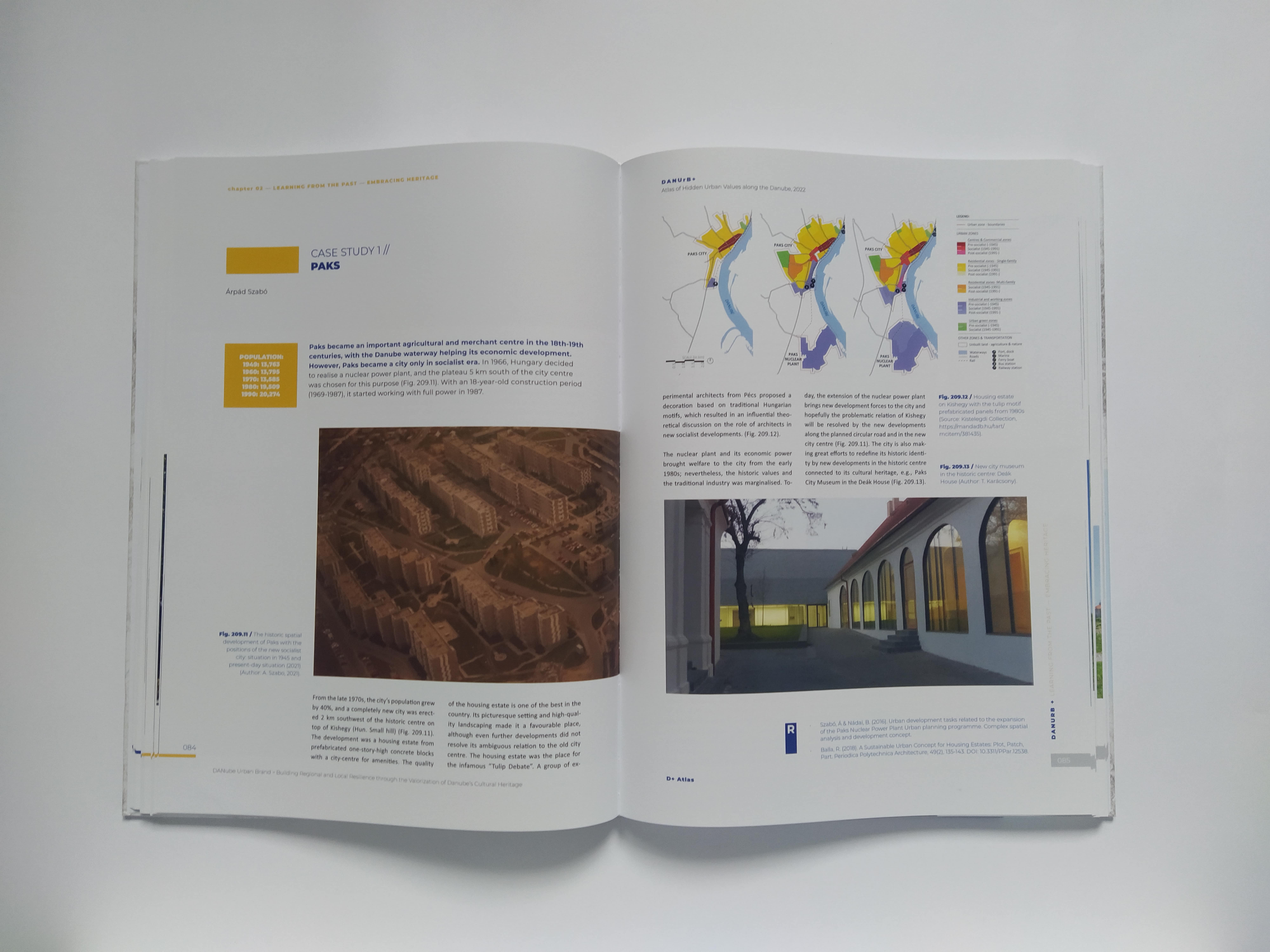
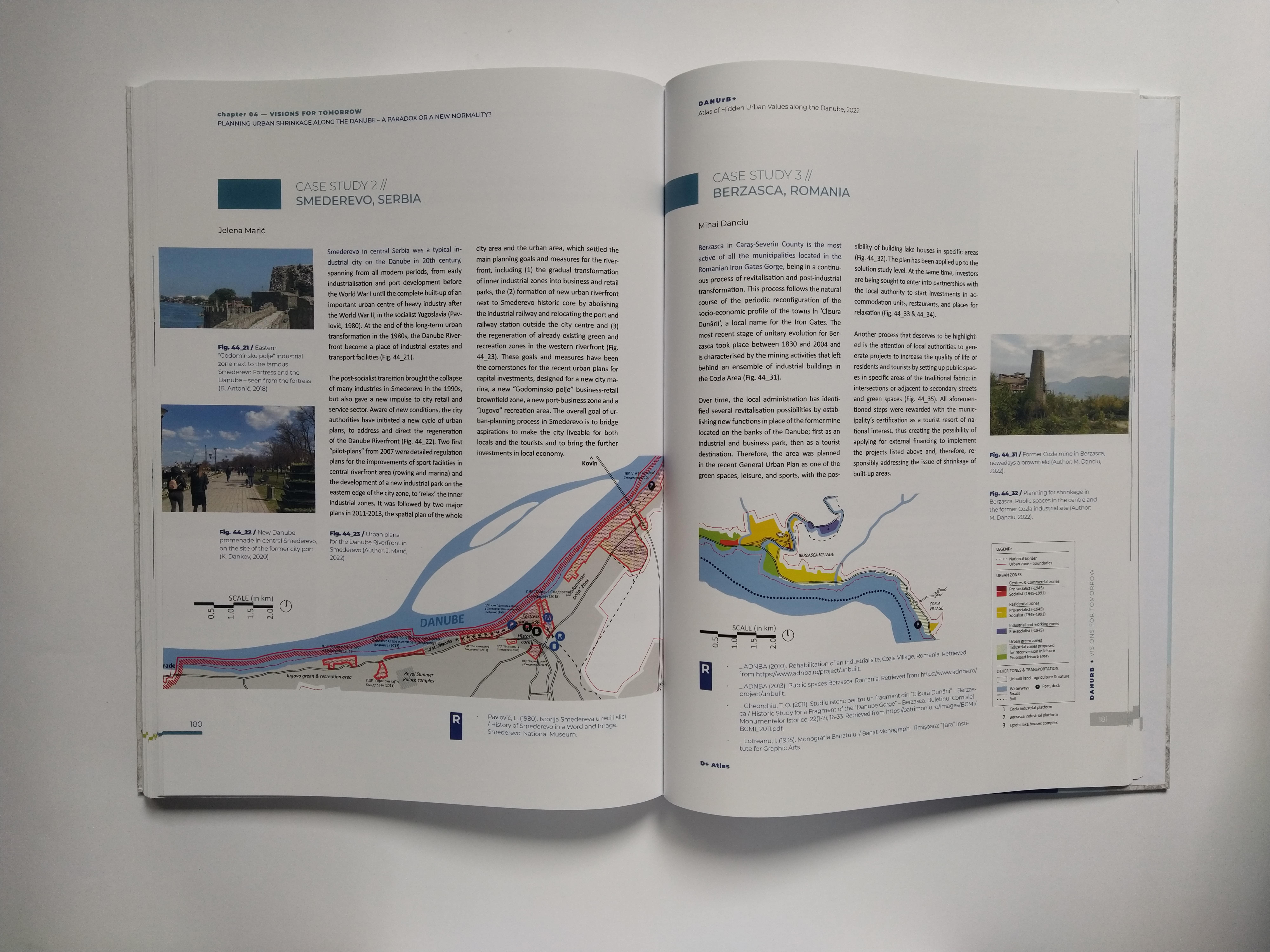
The hardcopy version of the D+ Atlas has four main chapters, which are arranged in a chronological order. The first one is “OVERVIEW”, and it is an introductory chapter which explains the basics of the atlas objectives, the main topic, scope, and content. The second chapter – “LEARNING FROM THE PAST – EMBRACING HERITAGE” – explains why the past of Danubian cities and towns matters today, through the showcases of local heritage, tradition, and legacy. The third chapter is “POTENTIALS AND CHALLENGES OF THE PRESENT” and this title perfectly highlights what is its aim – to reveal all these current peculiarities of Danubian places that positively and negatively shape the life of local population and the experience of external visitors. This is a critical approach, which is easily visible in the fourth chapter – “VISIONS FOR TOMORROW” – where the best urban practice along the Danube is underlined and examined. The main goal behind it is to show that all the mapped and analysed small and medium sized cities and towns along this major European river have prospects to radically improve their future by welcoming the sustainable ways of urban development, incorporating the rational usage, identity promotion and branding of its own cultural and natural, tangible, and intangible heritage. Between all mentioned chapters, the so-called “big maps” of the entire Danube Region are given, with more than 90 cities and towns mapped by their main social, demographic, economic, and communication features.
The digital version of the D+ Atlas is bit different, but in line with the newly embraced possibilities of innovative digital age. The atlas is based on a modern GIS platform, where prospective users can browse the uploaded data through several big topics, organised as navigation menus: demographics, economy, urban development, and case studies. In this way, users have full independence – they can search just the cities they favour or to pass through specific topics with several cities’ case studies.
The printed version of D+ Atlas: “ATLAS OF HIDDEN URBAN VALUES ALONG THE DANUBE” has been already distributed to all involved partners in the DANUrB+ Project. The official promotion of the atlas was organised on the first day of the “A Journey Connecting Communities” Closing Conference in Budapest, Hungary, on December 12, 2022. Moreover, the digital atlas is to be available through the newly developed DANUrB+ Project website by the end of 2022. This means that atlas will be easily accessible for all interested local and regional users across the Danube Region and beyond.

--------------------------------------------------------------------------
![]()
![]()
![]()
![]()
Project co-funded by European Union funds (ERDF and IPA).