SaveGREEN - Introducing the pilot areas of Austria: Aisterheim and Pöttsching
07-12-2021
Our second virtual trip with the SaveGREEN project takes us to the beautiful Kobernausser Forest, situated at the edge of the ecological corridor connecting the Austrian Alps with the Czech Republic, and to the village of Pöttsching, which lies on the Austrian side of the Alpine-Carpathian corridor. These two pilot areas in Austria are unique in that habitat fragmentation of the studied ecological corridors has already progressed significantly further than in some of the six neighbouring states. The primary focus of conservation efforts in Austria – rather than on preserving wildlife corridors and keeping them free of building development – is to reconnect remaining patches of wild habitat.
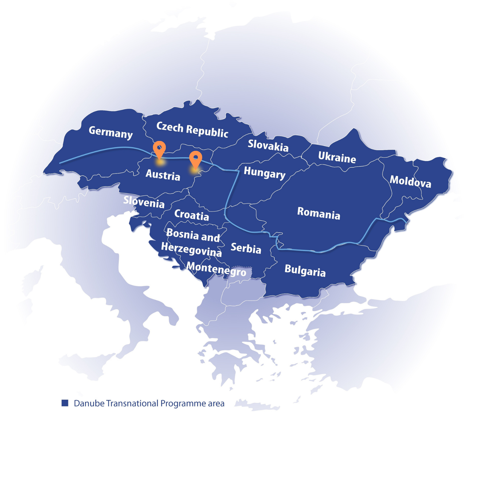
Pilot area map, Eszter Sebestyén, CEEweb
Passing through bottlenecks
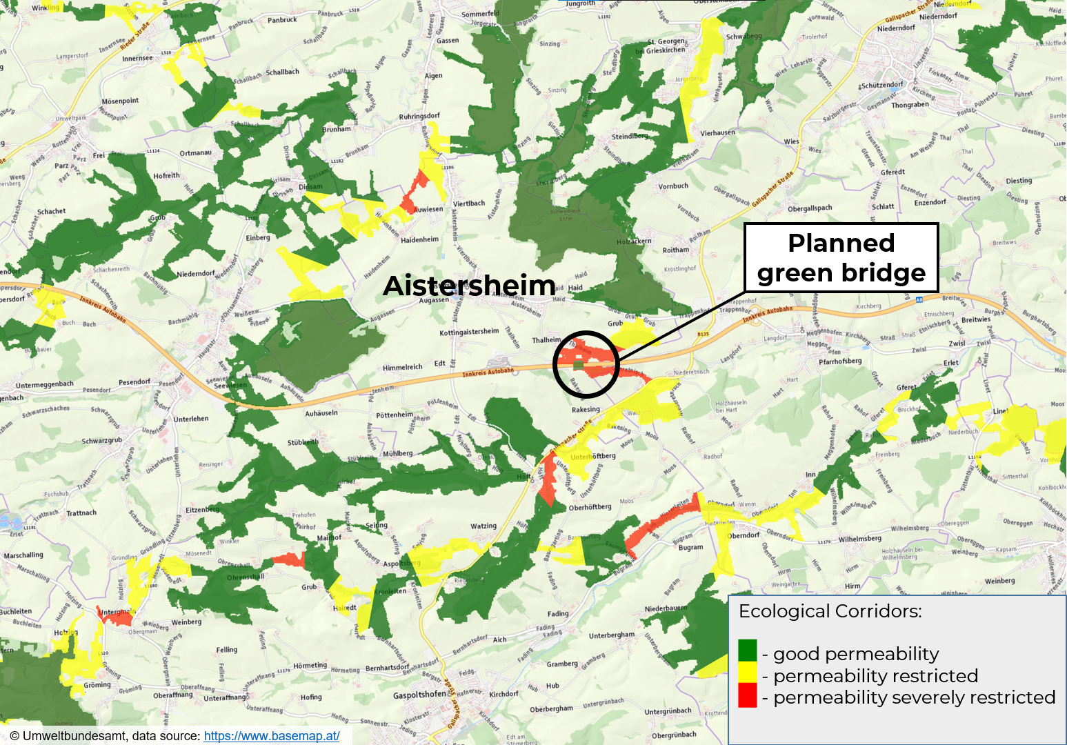
The village and municipality of Aistersheim sits at a critical bottleneck passage for wildlife migration that connects the Kobernausser Forest with Bavaria and the Czech Republic. The A8 highway cuts along the outer part of the village and poses a major barrier for wildlife. It was therefore decided to build a green bridge at this location, as well as connectivity strips to safely guide wildlife from the surrounding woodland to the bridge. It is the task of the Austrian SaveGREEN team to identify and monitor key bottleneck areas at the designated construction site of the green bridge and surrounding landscape: this will help to establish key baseline information from which to evaluate the effectiveness of the future overpass.
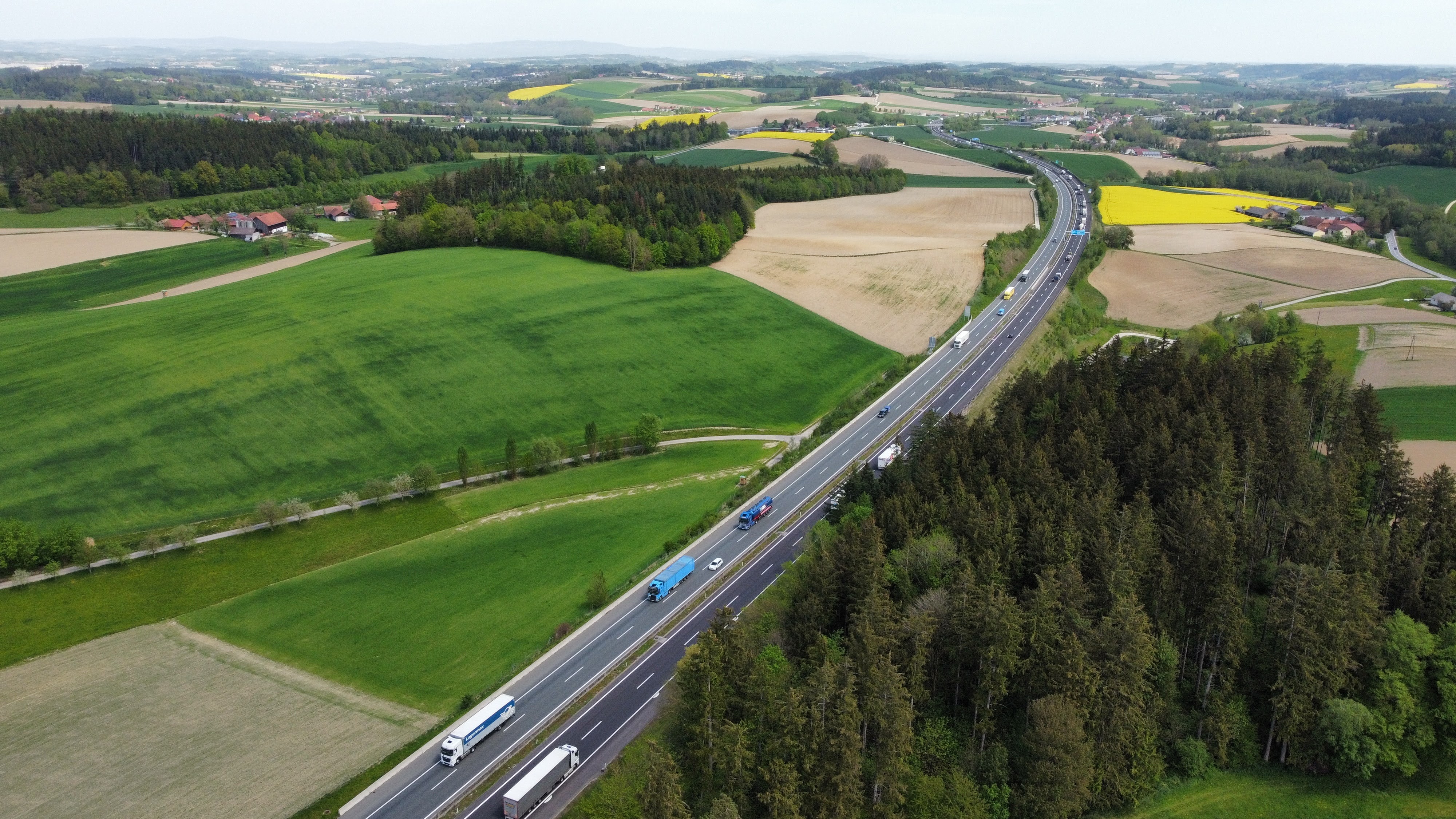 The A8 motorway at Aistersheim. © Grillmayer - Umweltbundesamt
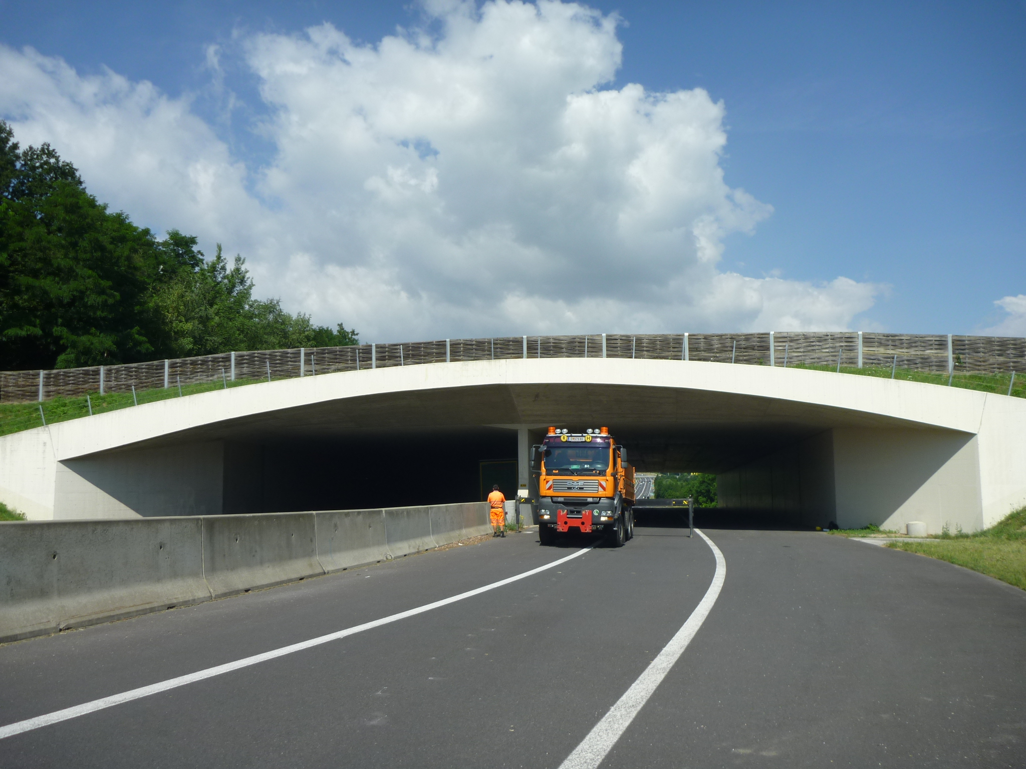 The green bridge at Pöttsching. © Grillmayer - Umweltbundesamt
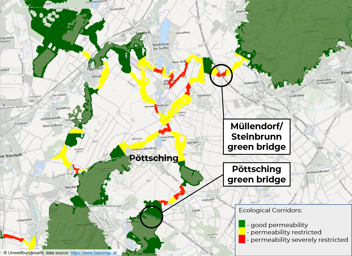
The second Austrian pilot area, Pöttsching, is another critical bottleneck passage for wildlife migration along the Alpine-Carpathian corridor, giving it transboundary significance. The villages of Pöttsching and Müllendorf/Steinbrunn have each constructed a green bridge to provide secure crossing points across the S4 and A3 highways – both major migration barriers in this part of the ecological corridor. SaveGREEN will monitor the overpasses to evaluate how wildlife navigates the space between the two green bridges, one of which is situated in a forest area, while the other is surrounded by arable land.
Habitat fragmentation and the importance of ecological connectivity
Habitat fragmentation is one of the leading causes of biodiversity loss around the world, and Austria, where only 7% of the territory remains in a largely natural state, is no exception. Manmade barriers (e.g. roads, rail lines, settlements, industrial and suburban sprawl, and intensive land use) and related disturbing factors (e.g. noise and light pollution) carve up wildlife habitats into small, unconnected areas where it is difficult to find food, shelter or a mate. Reduced gene flow between populations decreases the overall resilience of species: as their numbers dwindle, the health and resilience of the entire ecosystem begins to degrade.
The primary aim of the SaveGREEN project is to maintain and improve ecological connectivity in the Danube-Carpathian region. Ecological connectivity is the degree to which habitats, both small and large small, are interconnected to facilitate the movement of plants and animals. The development and maintenance of green corridors is an essential means of establishing ecological connectivity through fragmented habitats: in creating green corridors, it is important to consider both their physical integrity (structural connectivity) and which species use them and how (functional connectivity).
Ensuring the integrity and health of ecosystems is the key to providing ecosystem services on which we all depend, such as clean air and water, and the production of food and other natural resources, such as timber. Ecosystem health is also vital in terms of regulating our climate.
AFFECTED SPECIES:
- Beech marten (Martes foina)
- Hedgehog (Erinaceus europaeus)
- Common vole (Microtus arvalis)
- Least weasel (Mustela nivalis)
- Dormouse (family Myoxidae)
- Polecat (Mustela putorius)
- Eurasian beaver (Castor fiber)
- Red deer (Cervus elaphus)
- European badger (Meles meles)
- Red fox (Vulpes vulpes)
- European hare (Lepus europaeus)
- Red squirrel (Sciurus vulgaris)
- European otter (Lutra lutra)
- Roe deer (Capreolus capreolus)
- European pine marten (Martes martes)
- Stoat (Mustela ermine)
- European wildcat (Felis silvestris)
- Wild boar (Sus scrofa)
How does SaveGREEN help?
To counteract the effects of habitat fragmentation, existing corridors need to be actively and strictly preserved, and the already disrupted ones effectively restored. SaveGREEN contributes to these efforts by demonstrating how to appropriately and cooperatively design mitigation measures, taking into account the viewpoints of affected stakeholders (e.g. hunters, local and national authorities, local communities) and sectors (spatial planning, agriculture, forestry etc.).
It is also crucial to maintain and improve the functionality of ecological corridors, so another important task of SaveGREEN is to share and collect knowledge related to how and in which circumstances wildlife do or do not pass through particular sections.
An effective partnership
The SaveGREEN project partners responsible for project implementation in Austria are WWF Central & Eastern Europe (WWF-CEE) and the Environmental Agency Austria (EAA).
The EAA, as leader of the project’s technical work package, was responsible in the early stages for creating a mobile app to help monitor land use, track species movement, and make barrier assessments in ecological corridors. Rather than starting from scratch, the EAA opted to build on the open-source GIS system, QGIS, and its mobile app, QField, by creating a data package that can be used on these platforms. The data package is specifically tailored to the monitoring needs within SaveGREEN and facilitates data exchange between the pilot areas. Two strong advantages of the QGIS/QField platform are that these products are very user-friendly and will be freely available to field experts both during and after the project. The draft application is currently being tested in all SaveGREEN pilot areas, and a final, refined version will be available in March 2022.
The EAA has also deployed sensors next to wildlife cameras to measure the impacts of light and noise pollution on the SaveGREEN monitoring sites.
Not everything always goes perfectly according to plan, however. The project team has encountered some initial resistance from local landowners with regard to setting up the monitoring hardware, and we have invited numerous exchanges with the concerned parties to explain the significance of ecological corridors and the need to monitor their functionality. These challenges demonstrate the importance of engaging relevant stakeholders well in advance, and have provided the entire project consortium with a valuable lesson to be learned.
Looking to the future
The advanced state of fragmentation of Austria’s natural habitats offers a stark warning to other countries in the Danube-Carpathian region of what occurs when our plans for the future fail to take nature seriously. As the world is gradually coming to realise the extent to which our societies depend on healthy ecosystems and thriving biodiversity, countries like Austria must begin to reconnect and restore habitats that have been broken up or destroyed. This is task that involves a great deal of money and effort – but to do nothing or not enough comes at an even greater cost.
The work of SaveGREEN in the Austrian pilot areas is contributing to this effort by analysing the structural and functional status of ecological corridors, both before (Aistersheim) and after (Pöttsching) the construction of mitigation measures. These findings, combined with knowledge obtained in the course of numerous stakeholder exchanges to raise awareness about the issue and gain the support of all relevant actors, will not only be applied within the pilot areas themselves, but will prove extremely valuable in future defragmentation efforts in other areas in Austria and throughout Europe.
The project has produced two factsheets where you can learn more about these pilot areas.
The next stop on our virtual tour is Czechia, so stay tuned for the next article!
Follow our social media channels on Facebook and Twitter to stay updated, or subscribe to our newsletter to gain project insights!
Save nature: SaveGREEN!
Author:
Eszter Sebestyén, CEEweb
Contributed by:
Christophe Janz (WWF-CEE), Hildegard Meyer (WWF-CEE), Florian Borgwardt (Umweltbundesamt - EAA)