DanubeSediment - Data preparation, stakeholder workshops and joint measurements on the agenda of the project meeting in Belgrade
21-09-2017
How to represent river groynes in a GIS database? What is the situation of the availability of Danube data for the 19th century? How to prepare a meeting for stakeholders in each country? How to organize a common measurement campaign between Romania and Serbia?
These were just some of the questions in the focus of the internal DanubeSediment project meeting that took place in Belgrade on September 11th and 12th.
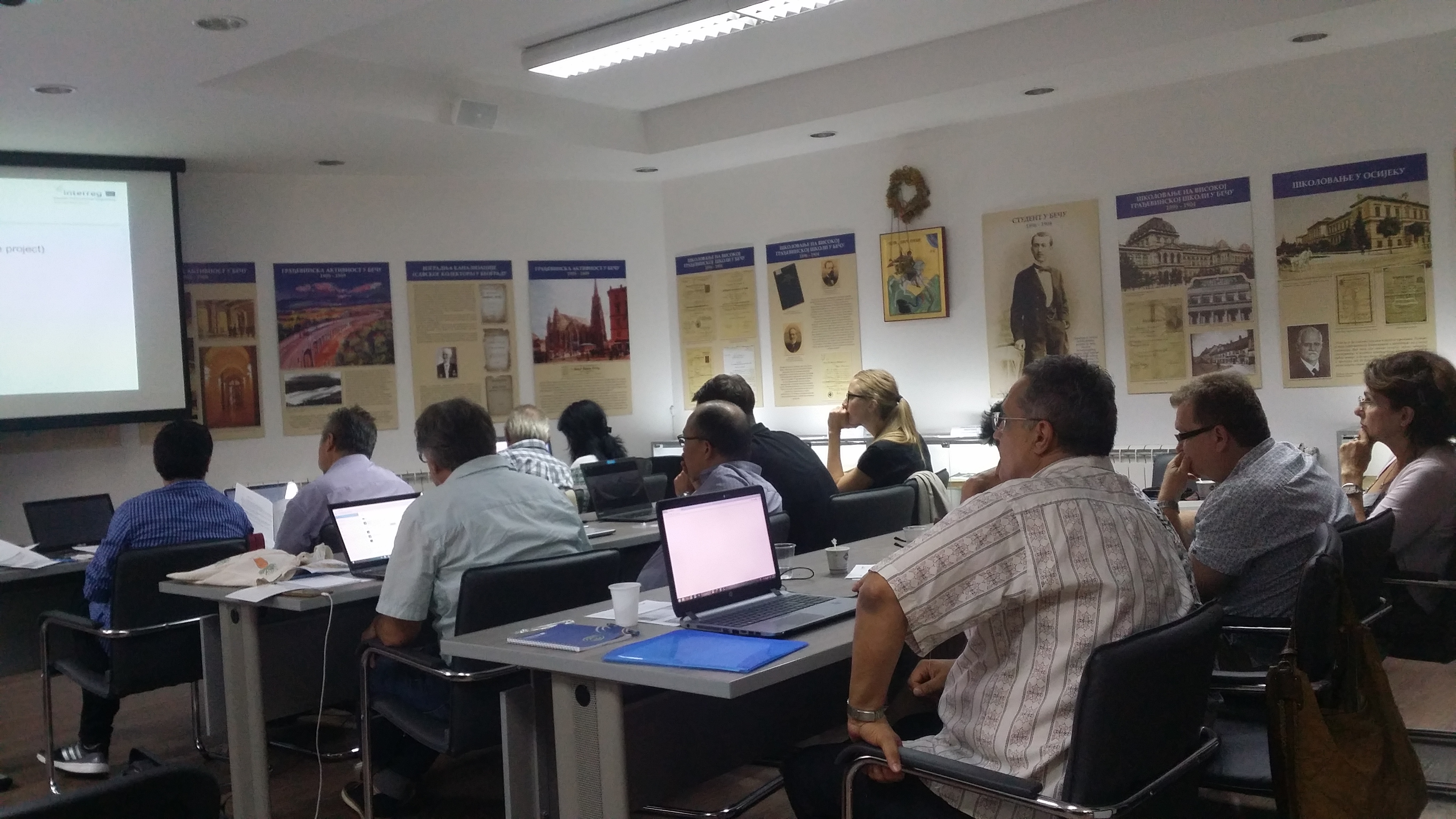
The conference room was dedicated to the memory of Milutin Milankovic – and offered project participants an opportunity to discover a perspective of a mainly unknown dimension of his activities: His work as a civil engineer.
With respect to DanubeSediment, the meeting helped put together pieces of the project partners’ work and gave an outlook on different aspects of the project work, e.g.
Sediment-relevant GIS data? – There is a large collection of data available via Danube GIS (https://www.danubegis.org/), but some of the relevant data is classified, some further data has been collected by other European research institutions and then there is the other side of the question: How do we deploy data so that in can be easily accessed by other projects and the public in the future.
Involving stakeholders? – National workshops will start soon. The first one will take place in Germany (10. 10.) and project partners in Serbia, Romania, Austria and Hungary are also planning their workshop for 2017 or begin of 2018. A pool of ideas of what could / should be on the agenda has been collected and possible interactive formats as well as the scope of the workshops - always taking into account the specific situations in each country - has been discussed.
Common measurement campaigns help to compare methods and to build up the understanding of what others are doing, especially taking into account that the measurement of sediment transport is a complex procedure and covers different settings and methods. Not to forget that also very practical aspects have to be thought of, as the capacity and availability of boats or the information of border authorities for international stretches.