D2C - Work must go on
31-03-2020
The COVID-19 epidemy stops meetings and off-line team work, however field work is still possible as well as online collaboration. The Slovak D2C project team recently worked on a vision of the pilot area from a point of view of connection of the Green Belt and the Carpathian Corridor. Despite pandemia a lot of field, mapping and GIS work was done to identify important migration corridors and barriers. We can even say that mapping of fences in landscape is much healthier and more immunity building than isolation in a home office...
Though it is the project work, its results are highly enriched by data and outputs of other projects implemented within the Danube Transnational Programme. An opportunity to collaborate with other projects and institutions in the same (geographical or expert) area and share data and outputs is very efficient advantage of EU projects.
See a few maps we work on/with:
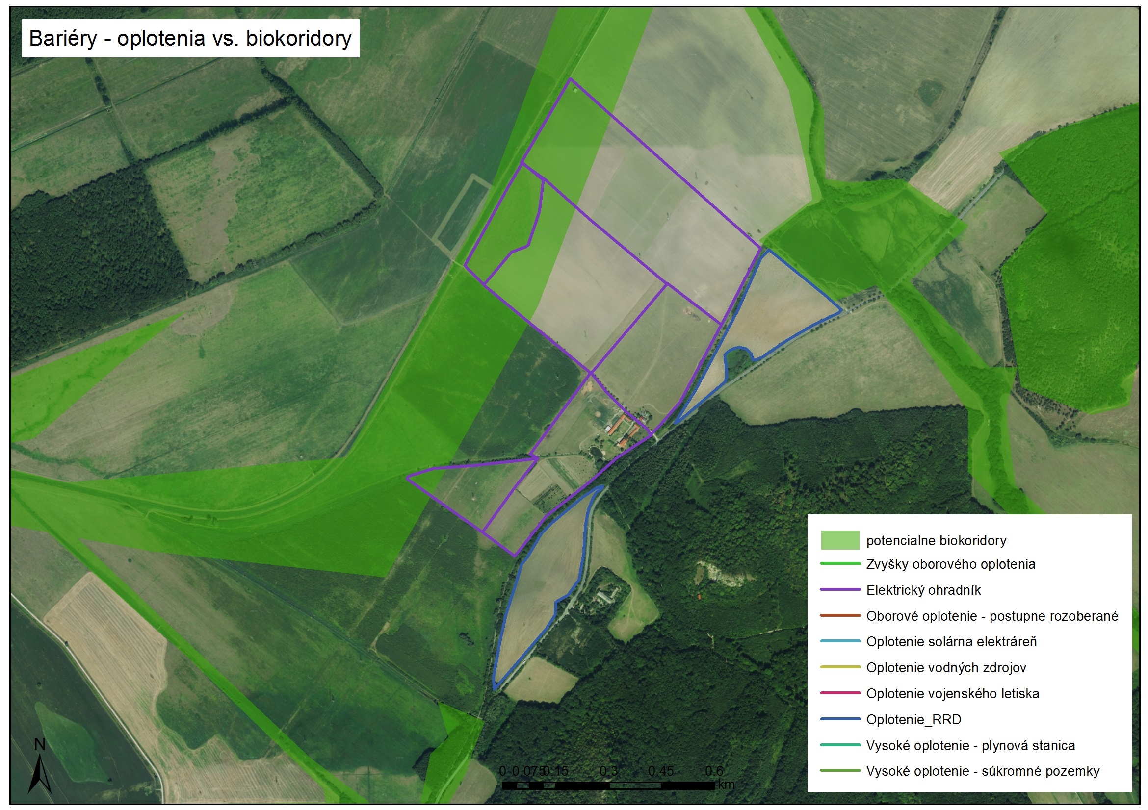
Barriers - fences vs. corridors
Green shade areas - potential corridors, purple lines - electrity fences, blue lines - fences

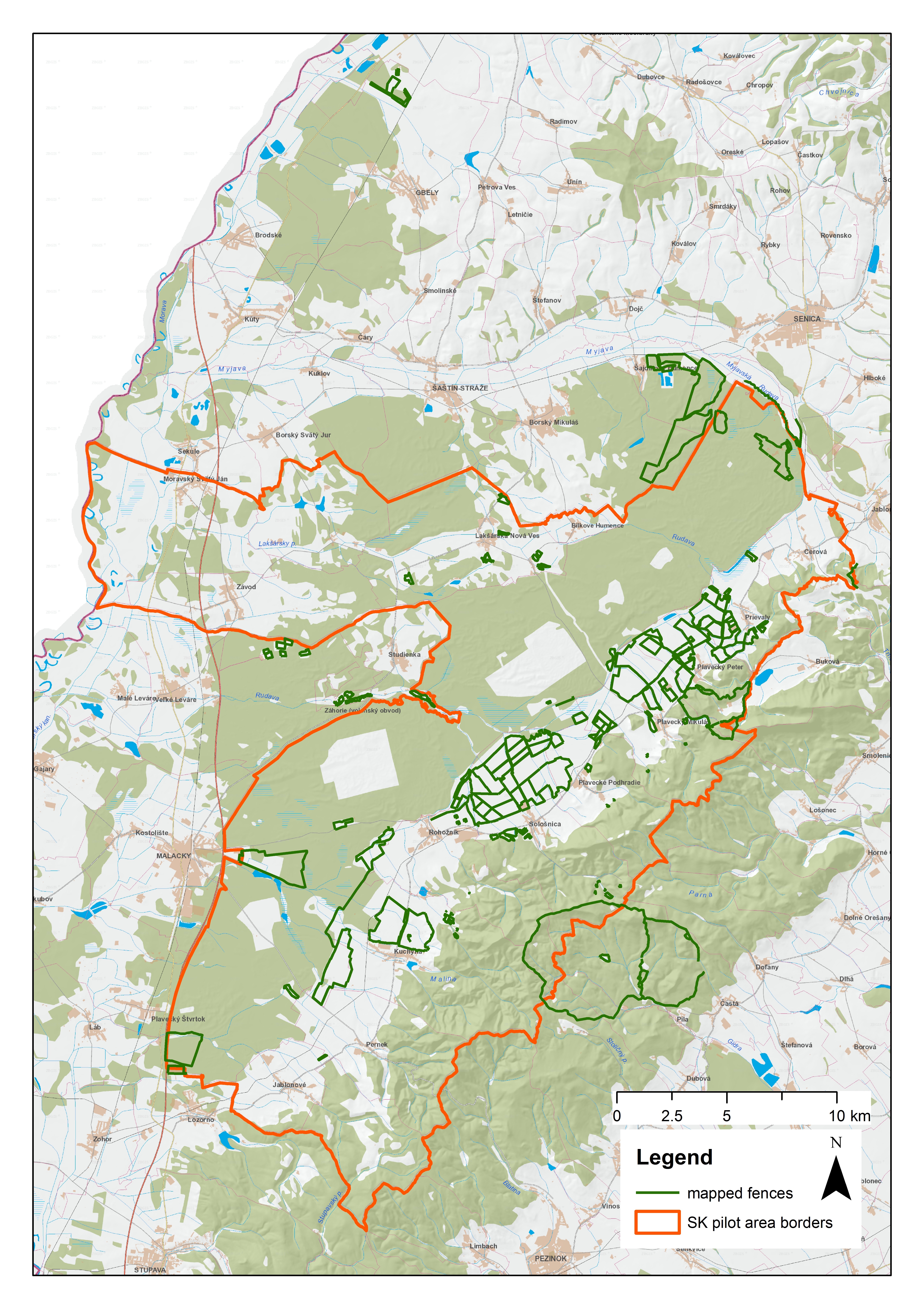
Map of all fences in the pilot area:

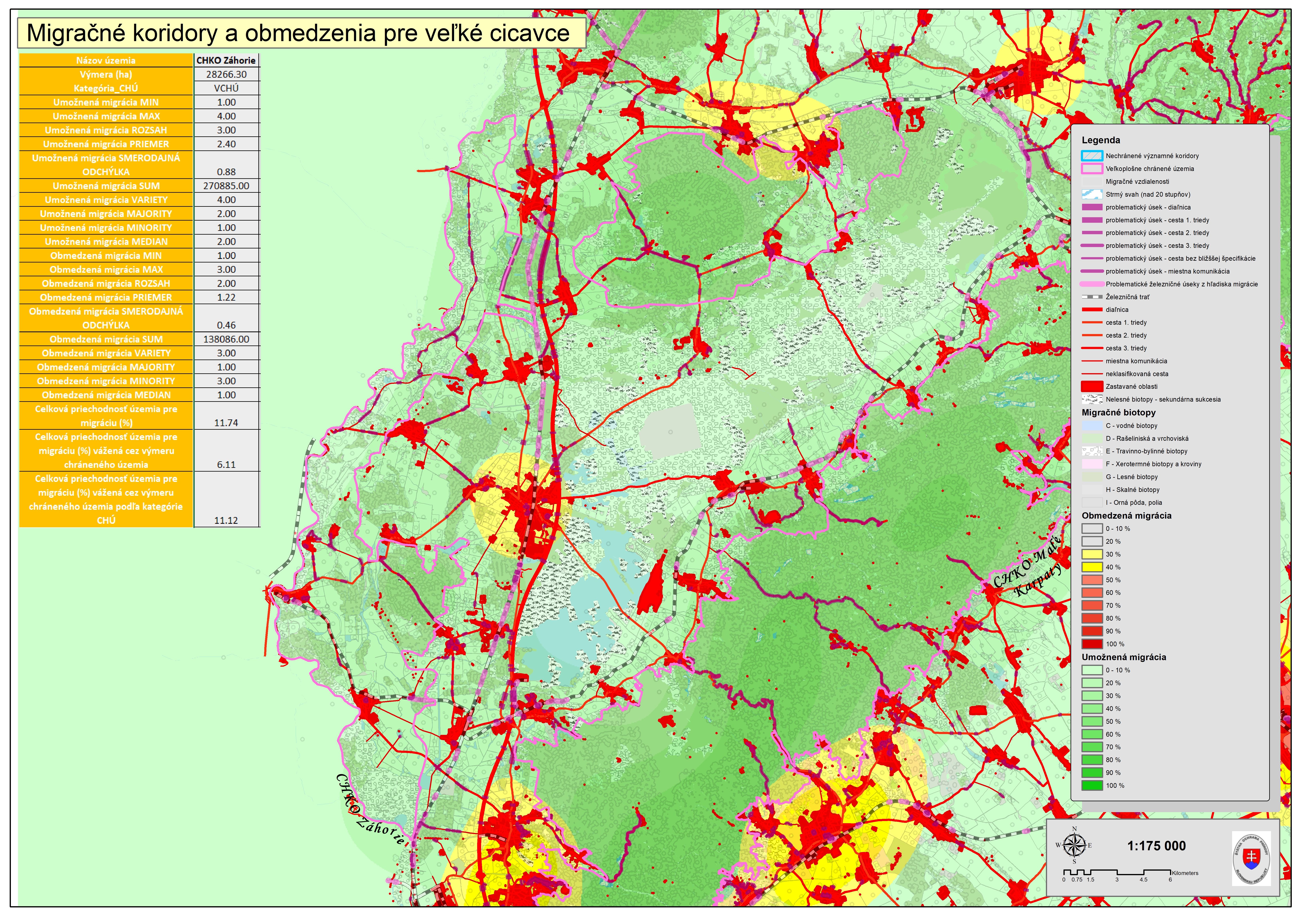
Map of large mammals migration corridors and barriers:

